MyTopo
Gunnison Utah US Topo Map
Couldn't load pickup availability
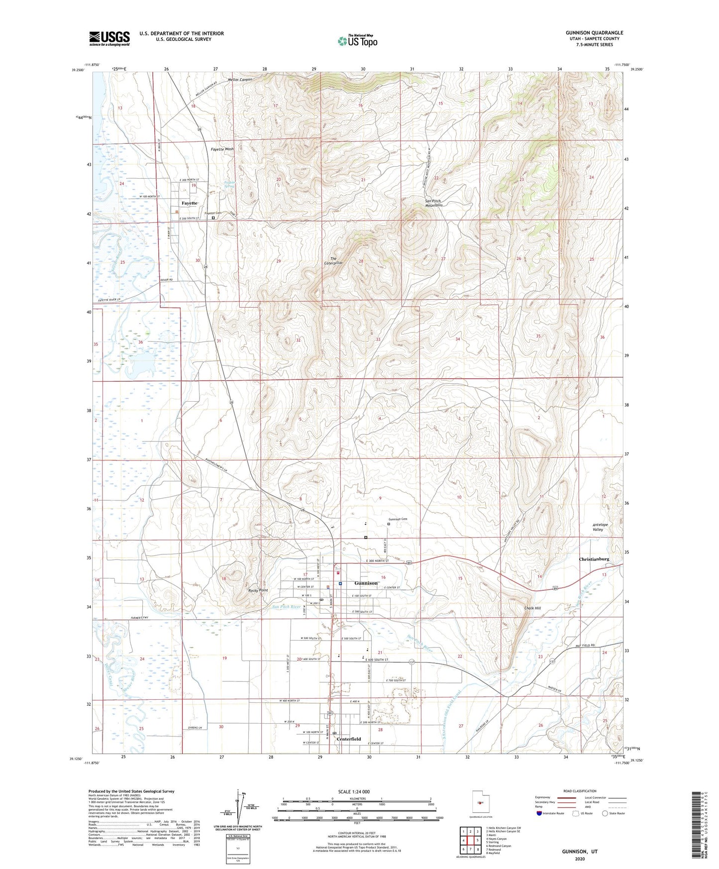
2020 topographic map quadrangle Gunnison in the state of Utah. Scale: 1:24000. Based on the newly updated USGS 7.5' US Topo map series, this map is in the following counties: Sanpete. The map contains contour data, water features, and other items you are used to seeing on USGS maps, but also has updated roads and other features. This is the next generation of topographic maps. Printed on high-quality waterproof paper with UV fade-resistant inks.
Quads adjacent to this one:
West: Hayes Canyon
Northwest: Hells Kitchen Canyon SW
North: Hells Kitchen Canyon SE
Northeast: Manti
East: Sterling
Southeast: Mayfield
South: Redmond
Southwest: Redmond Canyon
Contains the following named places: Antelope Valley, Centerfield, Centerfield Post Office, Central Utah Correctional Facility, Chalk Hill, Christianburg, City Ditch, City of Gunnison, Fayette, Fayette Cemetery, Fayette Spring, Fayette Wash, Fieldstone Academy, Gunnison, Gunnison Cemetery, Gunnison Division, Gunnison Fayette Canal, Gunnison Police Department, Gunnison Post Office, Gunnison Valley Ambulance, Gunnison Valley High School, Gunnison Valley Hospital, Gunnison Valley Volunteer Fire Department, KGVH-FM (Gunnison), Lunds Campground, Mellor Canyon, New Field Canal, Rocky Point, The Caterpillar, The Church of Jesus Christ of Latter Day Saints, Town of Centerfield, Town of Fayette, ZIP Code: 84634