MyTopo
Papoose Canyon Utah US Topo Map
Couldn't load pickup availability
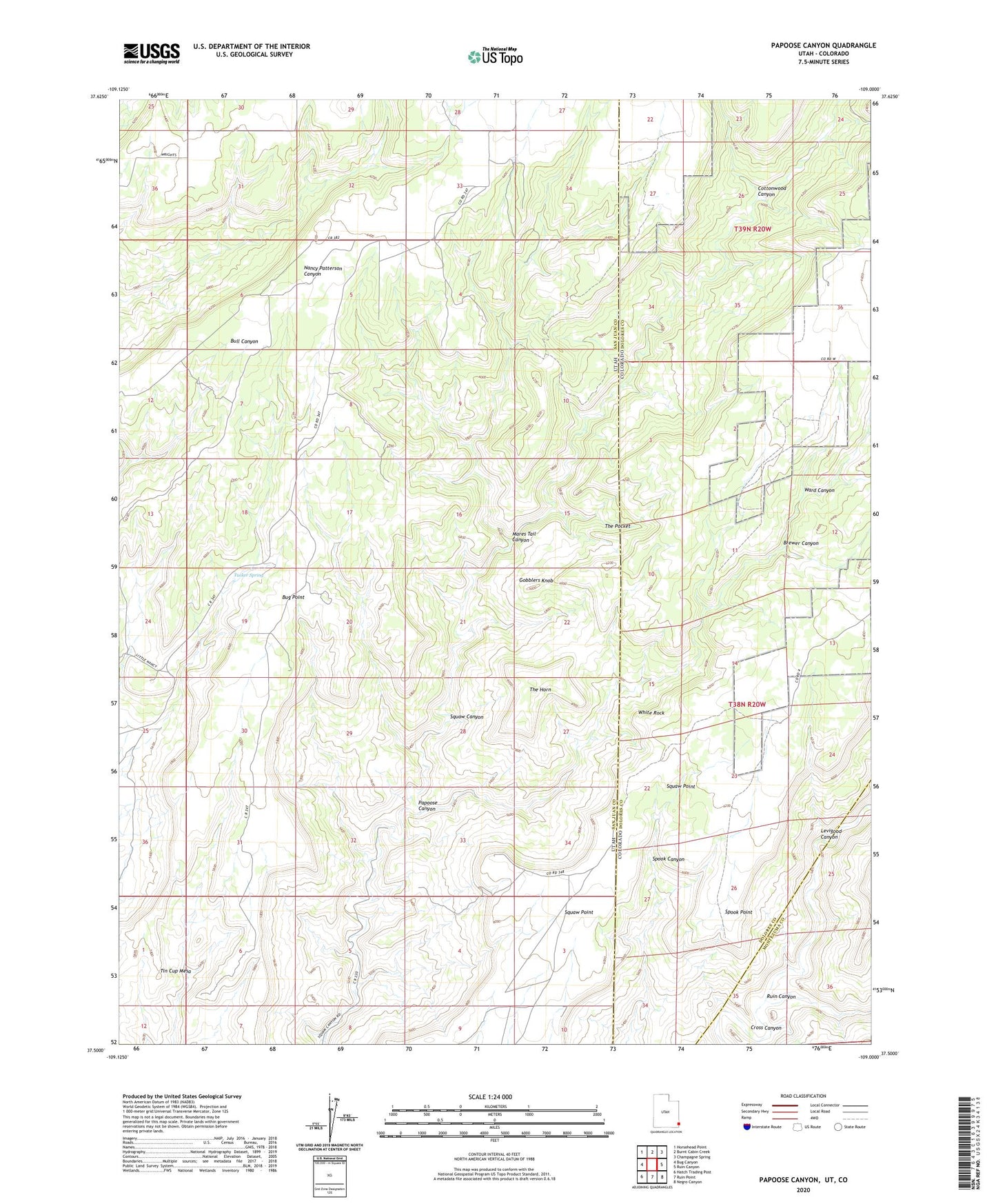
2023 topographic map quadrangle Papoose Canyon in the states of Utah, Colorado. Scale: 1:24000. Based on the newly updated USGS 7.5' US Topo map series, this map is in the following counties: San Juan, Dolores, Montezuma. The map contains contour data, water features, and other items you are used to seeing on USGS maps, but also has updated roads and other features. This is the next generation of topographic maps. Printed on high-quality waterproof paper with UV fade-resistant inks.
Quads adjacent to this one:
West: Bug Canyon
Northwest: Horsehead Point
North: Burnt Cabin Creek
Northeast: Champagne Spring
East: Ruin Canyon
Southeast: Negro Canyon
South: Ruin Point
Southwest: Hatch Trading Post
This map covers the same area as the classic USGS quad with code o37109e1.
Contains the following named places: Brewer Canyon, Brewer Well, Cottonwood Canyon, Gobblers Knob, Levigood Canyon, Mares Tail Canyon, Papoose Canyon, Ruin Canyon, Spook Point, The Horn, The Pocket, Tucker Spring, Ward Canyon, White Rock