MyTopo
Bug Canyon Utah US Topo Map
Couldn't load pickup availability
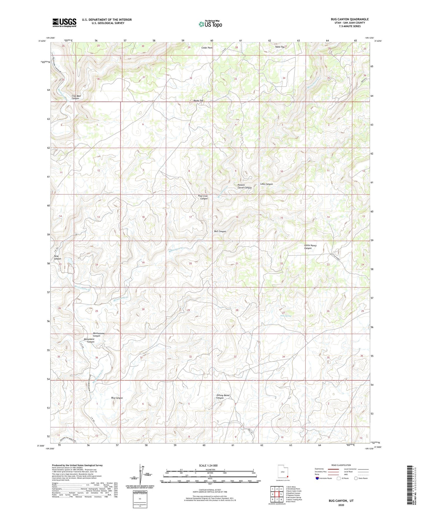
2023 topographic map quadrangle Bug Canyon in the state of Utah. Scale: 1:24000. Based on the newly updated USGS 7.5' US Topo map series, this map is in the following counties: San Juan. The map contains contour data, water features, and other items you are used to seeing on USGS maps, but also has updated roads and other features. This is the next generation of topographic maps. Printed on high-quality waterproof paper with UV fade-resistant inks.
Quads adjacent to this one:
West: Bradford Canyon
Northwest: Devil Mesa
North: Horsehead Point
Northeast: Burnt Cabin Creek
East: Papoose Canyon
Southeast: Ruin Point
South: Hatch Trading Post
Southwest: McCracken Spring
This map covers the same area as the classic USGS quad with code o37109e2.
Contains the following named places: Bonnie Dalton Artesian Well, Bug Canyon, Bull Canyon, Cedar Park, Coal Bed Canyon, Johnny Benal Canyon, Lake Canyon, Max Dalton Artesian Well, Montezuma Canyon, Monument Canyon, Monument Creek, Pickett Corral Canyon, Poor Cow Canyon, Rocky Top, Soda Spring, Tank Canyon