MyTopo
Haycock Mountain Utah US Topo Map
Couldn't load pickup availability
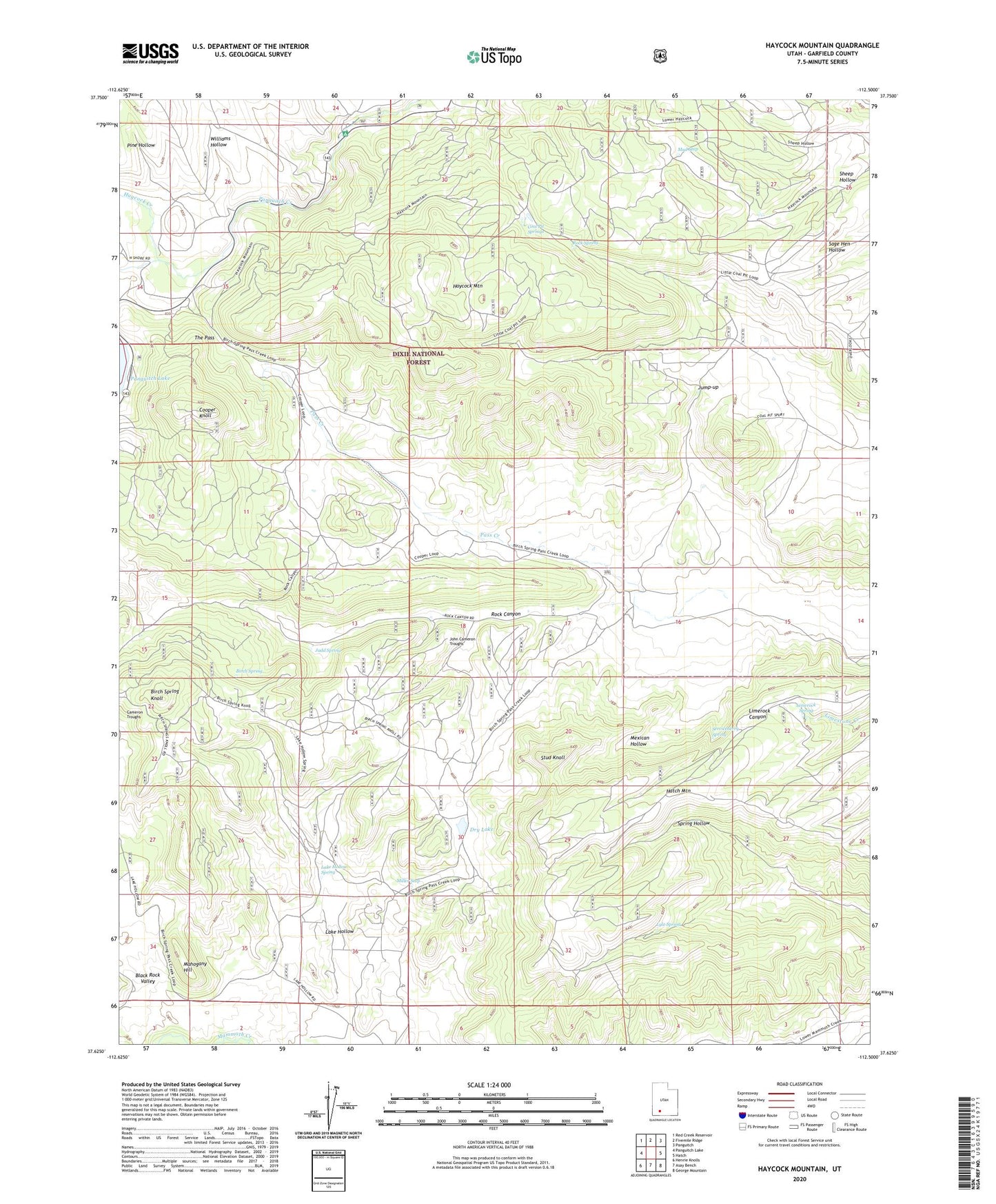
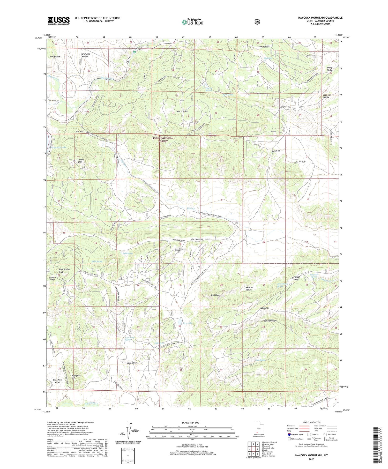
2020 topographic map quadrangle Haycock Mountain in the state of Utah. Scale: 1:24000. Based on the newly updated USGS 7.5' US Topo map series, this map is in the following counties: Garfield. The map contains contour data, water features, and other items you are used to seeing on USGS maps, but also has updated roads and other features. This is the next generation of topographic maps. Printed on high-quality waterproof paper with UV fade-resistant inks.
Quads adjacent to this one:
West: Panguitch Lake
Northwest: Red Creek Reservoir
North: Fivemile Ridge
Northeast: Panguitch
East: Hatch
Southeast: George Mountain
South: Asay Bench
Southwest: Henrie Knolls
Contains the following named places: Birch Spring, Birch Spring Knoll, Black Rock Valley, Cameron Wash, Coal Pit Springs, Cooper Knoll, Dry Lake, Hatch Mountain, Haycock Creek, Haycock Mountain, John Cameron Troughs, Judd Spring, Jump-up, Juniper Park Resort, Lake Hollow, Lake Hollow Spring, Lake View Resort, Limerock Spring, Little Coal Pit Wash, Lyle Spring, Mahogany Hill, Mexican Hollow, Miller Seep, Mud Seep, Pass Creek, Pine Hollow, Rock Spring, Serviceberry Spring, Stud Knoll, The Pass, White Bridge Campground, Williams Hollow