MyTopo
Hebron Utah US Topo Map
Couldn't load pickup availability
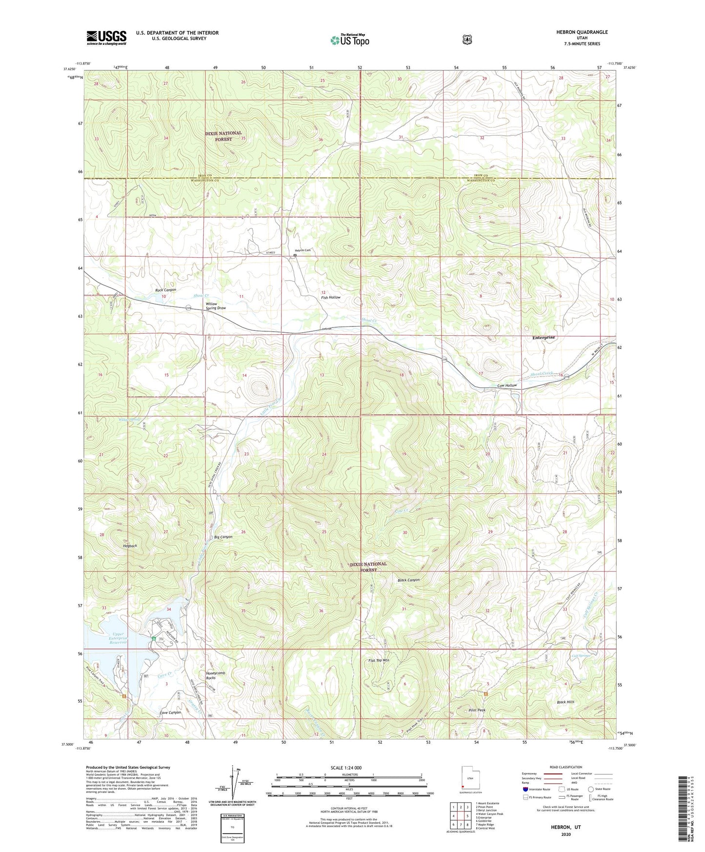
2020 topographic map quadrangle Hebron in the state of Utah. Scale: 1:24000. Based on the newly updated USGS 7.5' US Topo map series, this map is in the following counties: Washington, Iron. The map contains contour data, water features, and other items you are used to seeing on USGS maps, but also has updated roads and other features. This is the next generation of topographic maps. Printed on high-quality waterproof paper with UV fade-resistant inks.
Quads adjacent to this one:
West: Water Canyon Peak
Northwest: Mount Escalante
North: Pinon Point
Northeast: Beryl Junction
East: Enterprise
Southeast: Central West
South: Maple Ridge
Southwest: Goldstrike
Contains the following named places: Big Canyon, Calf Springs, Cave Canyon, Cave Creek, Cow Creek, Cow Hollow, Enterprise Reservoir Campground, Fish Hollow, Flat Top Mountain, Grassy Creek, Hebron, Hebron Cemetery, Hebron Historical Site, Hogback, Hollow Trail, Honeycomb Rock Campground, Honeycomb Rocks, Little Pine Creek, Lost Creek, Lower Enterprise Dam, Lower Enterprise Reservoir, Pilot Peak, Pilot Peak Trail, Rock Canyon, Upper Enterprise Dam, Upper Enterprise Reservoir, Willow Spring, Willow Spring Draw, ZIP Code: 84725