MyTopo
Heller Lake Utah US Topo Map
Couldn't load pickup availability
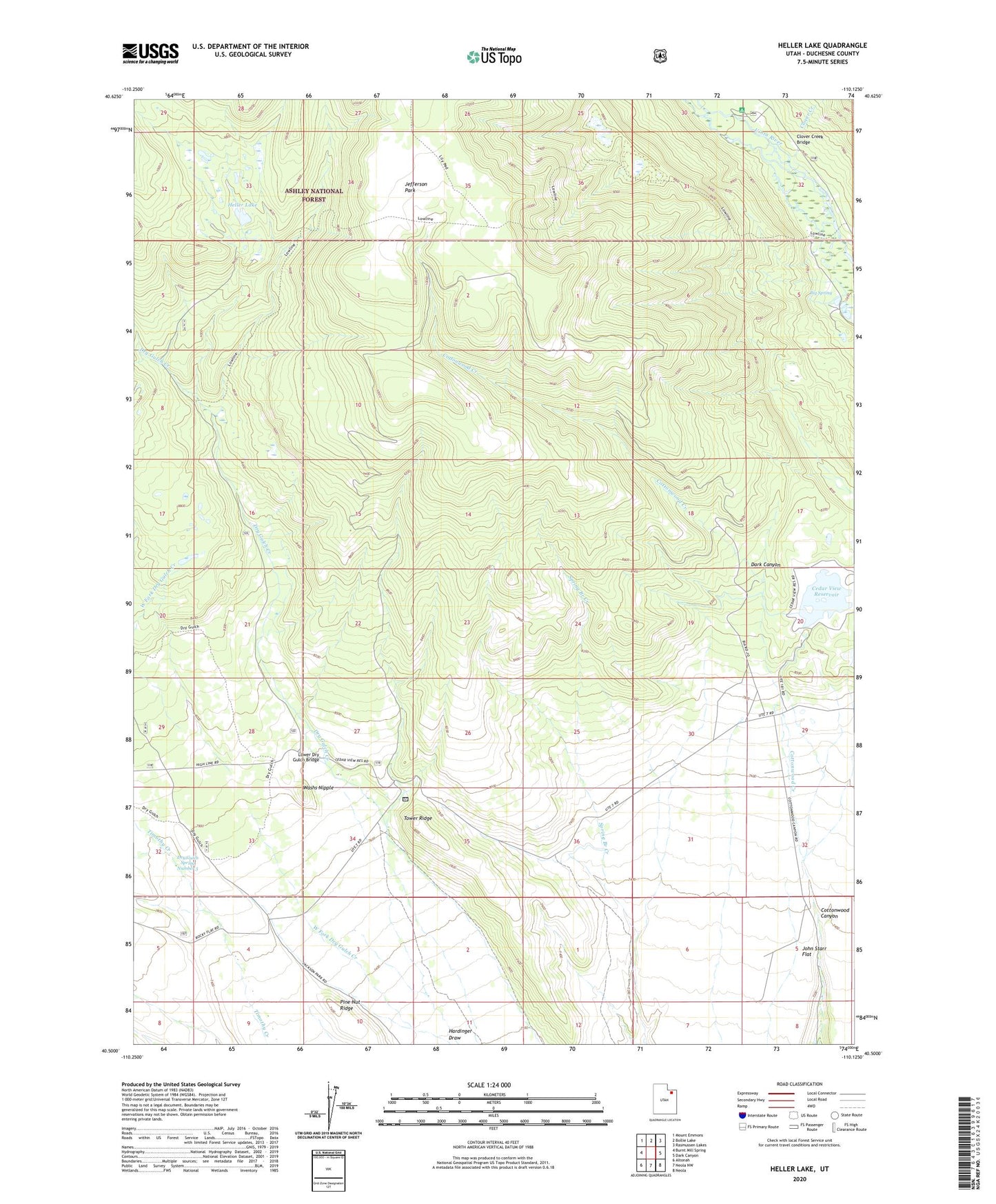
2020 topographic map quadrangle Heller Lake in the state of Utah. Scale: 1:24000. Based on the newly updated USGS 7.5' US Topo map series, this map is in the following counties: Duchesne. The map contains contour data, water features, and other items you are used to seeing on USGS maps, but also has updated roads and other features. This is the next generation of topographic maps. Printed on high-quality waterproof paper with UV fade-resistant inks.
Quads adjacent to this one:
West: Burnt Mill Spring
Northwest: Mount Emmons
North: Bollie Lake
Northeast: Rasmussen Lakes
East: Dark Canyon
Southeast: Neola
South: Neola NW
Southwest: Altonah
Contains the following named places: Big Spring, Big Spring Recreation Area, Cedar View Reservoir, Clover Creek, Clover Creek Bridge, Dark Canyon, Dry Gulch Cattle Camp, Dry Gulch Ranger Station, Dry Gulch Spring Number 3, Hardinger Draw, Heller Lake, Heller Lake Dam, Jefferson Park, John Starr Flat, Lower Dry Gulch Bridge, Pine Nut Ridge, Tower Ridge, Uinta Canyon Campground, Washs Nipple