MyTopo
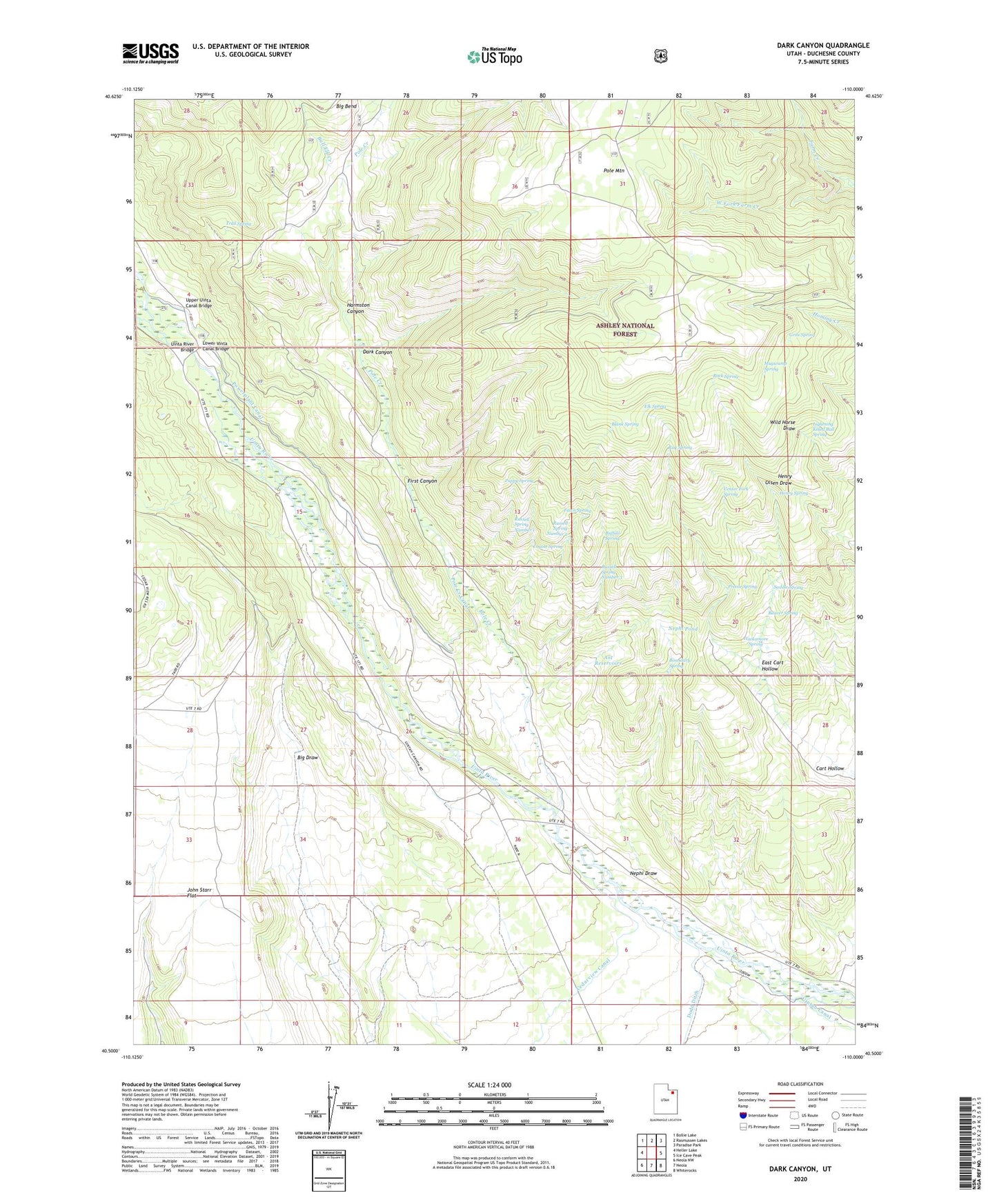
Dark Canyon Utah US Topo Map
Couldn't load pickup availability
Also explore the Dark Canyon Forest Service Topo of this same quad for updated USFS data
2023 topographic map quadrangle Dark Canyon in the state of Utah. Scale: 1:24000. Based on the newly updated USGS 7.5' US Topo map series, this map is in the following counties: Duchesne. The map contains contour data, water features, and other items you are used to seeing on USGS maps, but also has updated roads and other features. This is the next generation of topographic maps. Printed on high-quality waterproof paper with UV fade-resistant inks.
Quads adjacent to this one:
West: Heller Lake
Northwest: Bollie Lake
North: Rasmussen Lakes
Northeast: Paradise Park
East: Ice Cave Peak
Southeast: Whiterocks
South: Neola
Southwest: Neola NW
Contains the following named places: Ant Reservoirs, Beaver Spring, Blank Spring, Boundary Spring, Buffalo Spring, Bull Elk Creek, Cart Hollow, Center Fork Spring, Coyote Spring, Dark Canyon, East Cart Hollow, Elk Spring, Fawn Spring, First Canyon, Grits Spring, Hackamore Spring, Harmston Canyon, Henry Spring, Lightning Killed Bull Spring, Lower Vinta Canal Bridge, Mugwump Spring, Nephi Draw, Nephi Pond, Pole Creek, Pole Creek Canal, Powerplant Canal, Preece Spring, Puppy Spring, Ray Spring, Rock Spring, Russell Spring Number 1, Russell Spring Number 2, Russell Spring Number 3, Saddle Spring, Trail Spring, Uinta Canyon Summer Homes, Uinta River Bridge, Uintah Canyon Youth Camp, Uintah Powerplant, Upper Uinta Canal Bridge, West Fork Farm Creek, Zeagher Cabin