MyTopo
Kanab Utah US Topo Map
Couldn't load pickup availability
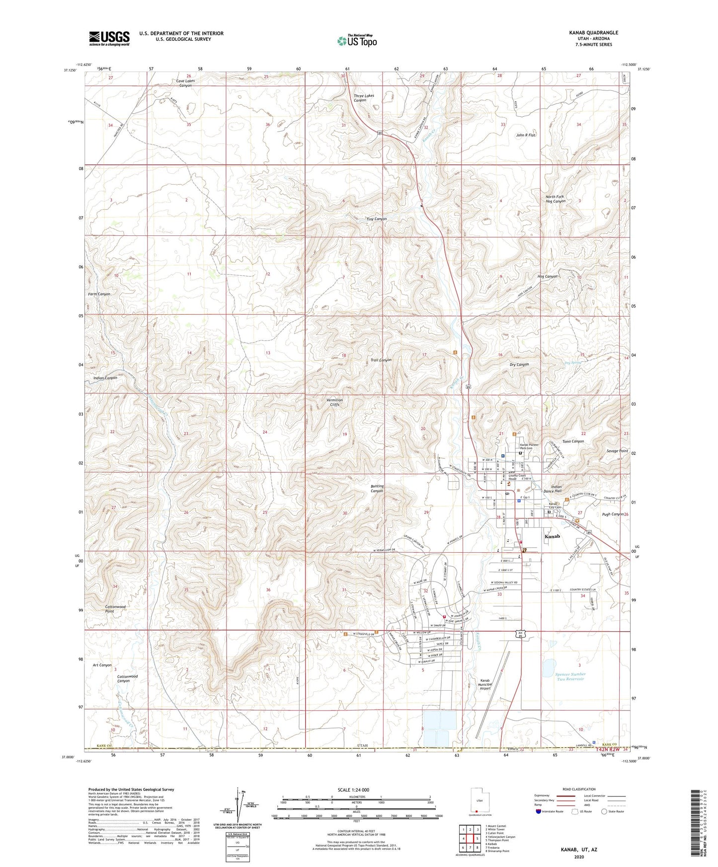
2023 topographic map quadrangle Kanab in the state of Utah. Scale: 1:24000. Based on the newly updated USGS 7.5' US Topo map series, this map is in the following counties: Kane, Mohave, Coconino. The map contains contour data, water features, and other items you are used to seeing on USGS maps, but also has updated roads and other features. This is the next generation of topographic maps. Printed on high-quality waterproof paper with UV fade-resistant inks.
Quads adjacent to this one:
West: Yellowjacket Canyon
Northwest: Mount Carmel
North: White Tower
Northeast: Cutler Point
East: Thompson Point
Southeast: Shinarump Point
South: Fredonia
Southwest: Kaibab
This map covers the same area as the classic USGS quad with code o37112a5.
Contains the following named places: Art Canyon, Bunting Canyon, Cave Lakes Canyon, City of Kanab, Cottonwood Canyon, Cottonwood Point, Crazy Horse Campark, Dinosaur Tracks, Dry Canyon, Dry Spring, Farm Canyon, First Baptist Church, Hog Canyon, Indian Canyon, Indian Dance Hall, Kanab, Kanab City Cemetery, Kanab City Police Department, Kanab Elementary School, Kanab Fire Department, Kanab Fire Department Ranchos Fire House, Kanab High School, Kanab Municipal Airport, Kanab Pioneer Park Cemetery, Kanab Post Office, Kane County Ambulance, Kane County Ambulance Kanab, Kane County Hospital, Kane County Sheriffs Office, Littles Campground and RV Park, North Fork Hog Canyon, Old Movie Fort, Pugh Canyon, Saint Christopher Catholic Church, Savage Point, Spencer Number Two Dam, Spencer Number Two Reservoir, The Church of Jesus Christ of Latter Day Saints, Three Lakes Canyon, Tiny Canyon, Toms Canyon, Trail Canyon, Utah Highway Patrol Section 9 Kanab Office