MyTopo
Kaibab Arizona US Topo Map
Couldn't load pickup availability
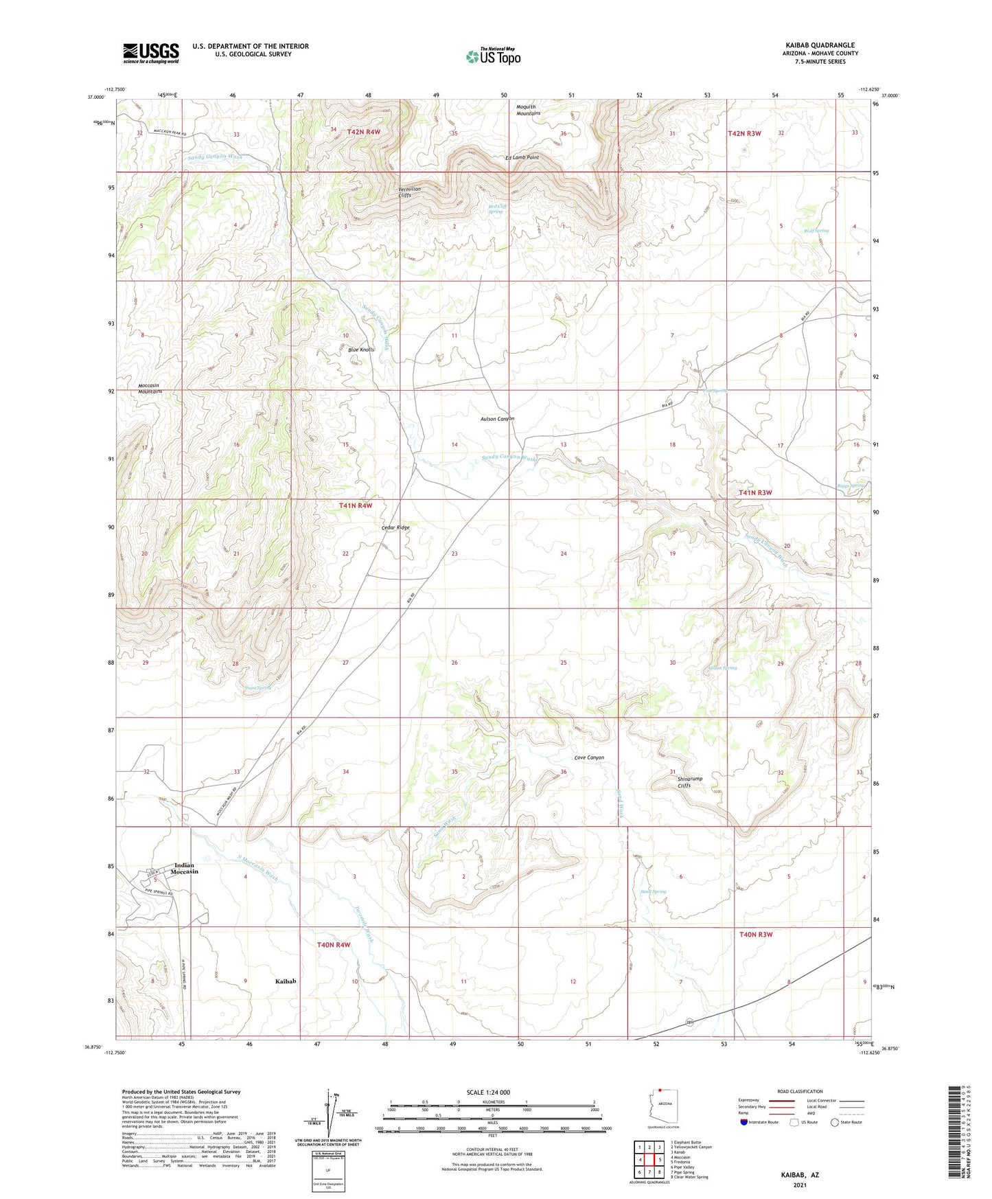
2021 topographic map quadrangle Kaibab in the state of Arizona. Scale: 1:24000. Based on the newly updated USGS 7.5' US Topo map series, this map is in the following counties: Mohave. The map contains contour data, water features, and other items you are used to seeing on USGS maps, but also has updated roads and other features. This is the next generation of topographic maps. Printed on high-quality waterproof paper with UV fade-resistant inks.
Quads adjacent to this one:
West: Moccasin
Northwest: Elephant Butte
North: Yellowjacket Canyon
Northeast: Kanab
East: Fredonia
Southeast: Clear Water Spring
South: Pipe Spring
Southwest: Pipe Valley
This map covers the same area as the classic USGS quad with code o36112h6.
Contains the following named places: Aulson Spring, Blue Knolls, Cedar Ridge, Cove Canyon, Ed Lamb Point, Indian Moccasin, Kaibab, Kaibab Census Designated Place, Kaibab Indian Reservation, Pine Spring, Point Spring, Red Cliff Spring, Riggs Spring, Sand Spring, Shinarump Cliffs, Stock Pond, Twomile Corrals, Wolf Spring