MyTopo
Thompson Point Utah US Topo Map
Couldn't load pickup availability
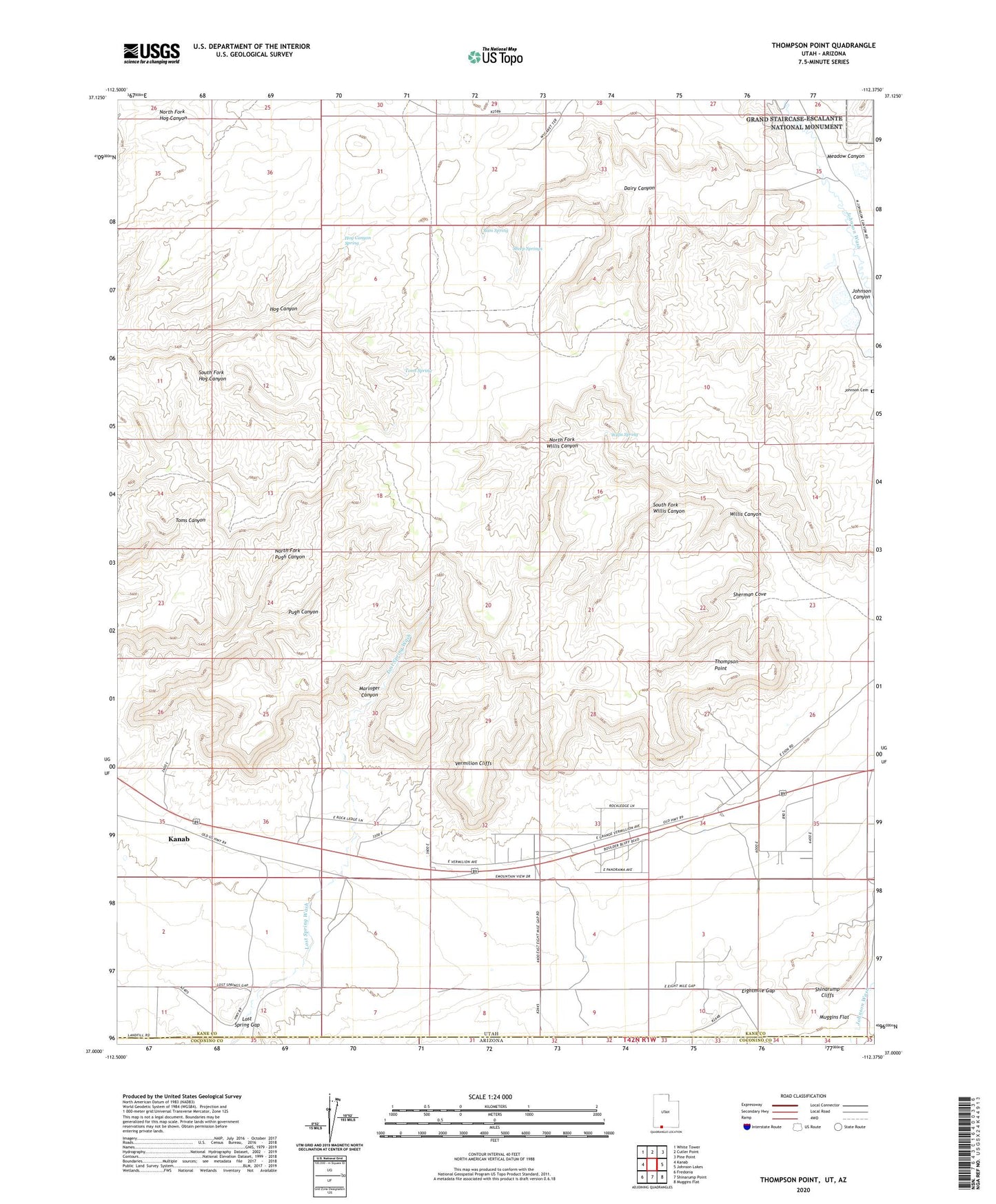
2023 topographic map quadrangle Thompson Point in the state of Utah. Scale: 1:24000. Based on the newly updated USGS 7.5' US Topo map series, this map is in the following counties: Kane, Coconino. The map contains contour data, water features, and other items you are used to seeing on USGS maps, but also has updated roads and other features. This is the next generation of topographic maps. Printed on high-quality waterproof paper with UV fade-resistant inks.
Quads adjacent to this one:
West: Kanab
Northwest: White Tower
North: Cutler Point
Northeast: Pine Point
East: Johnson Lakes
Southeast: Muggins Flat
South: Shinarump Point
Southwest: Fredonia
This map covers the same area as the classic USGS quad with code o37112a4.
Contains the following named places: Dairy Canyon, Hog Canyon Spring, Johnson Cemetery, Maringer Canyon, Meadow Canyon, North Fork Pugh Canyon, North Fork Willis Canyon, Ram Spring, Robinson Ranch, Sheep Springs, Sherman Cove, South Fork Hog Canyon, South Fork Willis Canyon, Thompson Point, Toms Spring, Willis Canyon, Willis Spring