MyTopo
White Tower Utah US Topo Map
Couldn't load pickup availability
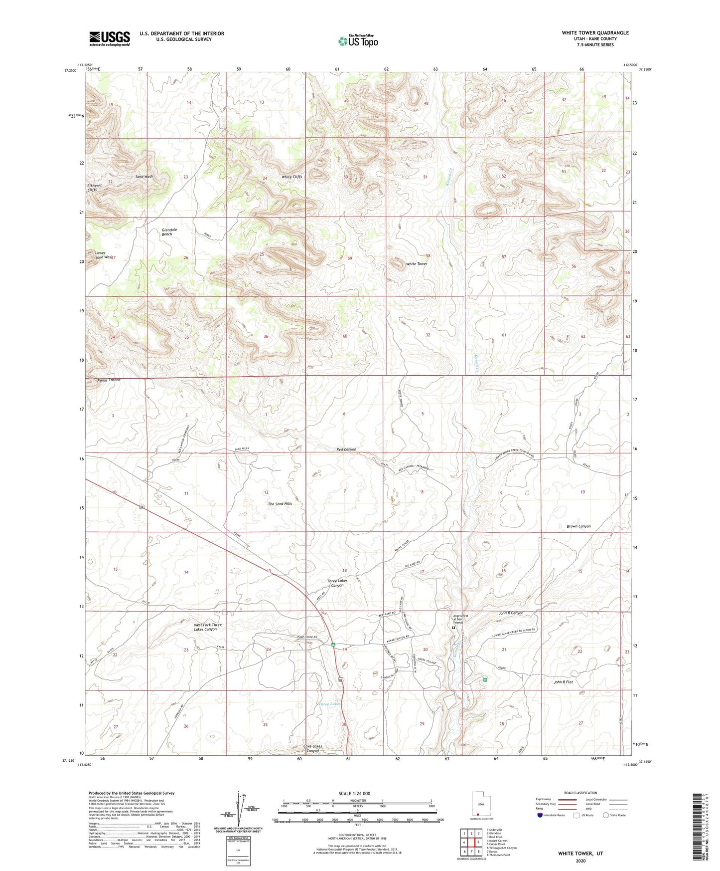
2023 topographic map quadrangle White Tower in the state of Utah. Scale: 1:24000. Based on the newly updated USGS 7.5' US Topo map series, this map is in the following counties: Kane. The map contains contour data, water features, and other items you are used to seeing on USGS maps, but also has updated roads and other features. This is the next generation of topographic maps. Printed on high-quality waterproof paper with UV fade-resistant inks.
Quads adjacent to this one:
West: Mount Carmel
Northwest: Orderville
North: Glendale
Northeast: Bald Knoll
East: Cutler Point
Southeast: Thompson Point
South: Kanab
Southwest: Yellowjacket Canyon
This map covers the same area as the classic USGS quad with code o37112b5.
Contains the following named places: Angels Rest at Best Friends, Big Lake, Brown Canyon, John R Canyon, John R Flat, Red Canyon, The Sand Hills, Three Lakes, West Fork Three Lakes Canyon, White Tower