MyTopo
Koosharem Utah US Topo Map
Couldn't load pickup availability
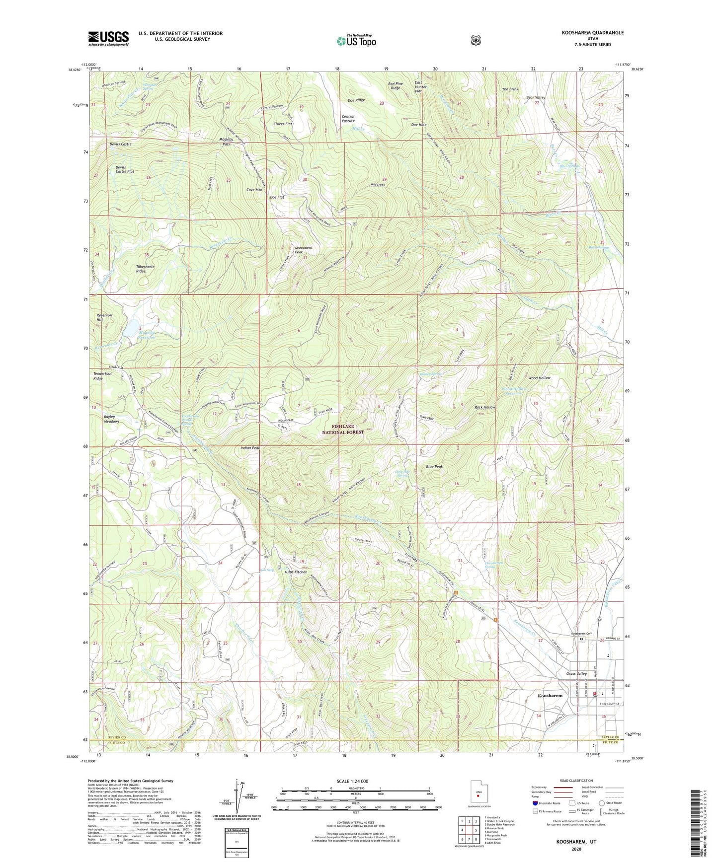
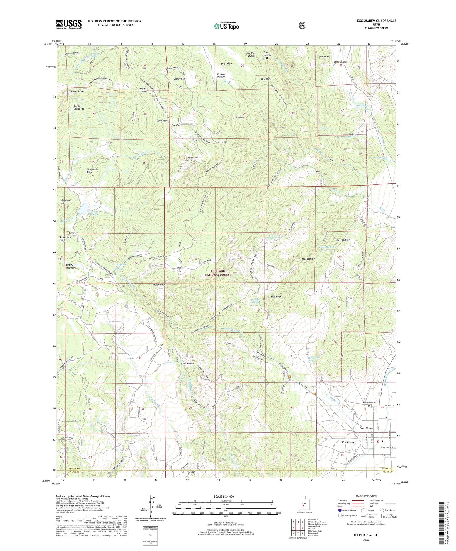
2020 topographic map quadrangle Koosharem in the state of Utah. Scale: 1:24000. Based on the newly updated USGS 7.5' US Topo map series, this map is in the following counties: Sevier, Piute. The map contains contour data, water features, and other items you are used to seeing on USGS maps, but also has updated roads and other features. This is the next generation of topographic maps. Printed on high-quality waterproof paper with UV fade-resistant inks.
Quads adjacent to this one:
West: Monroe Peak
Northwest: Annabella
North: Water Creek Canyon
Northeast: Boobe Hole Reservoir
East: Burrville
Southeast: Abes Knoll
South: Greenwich
Southwest: Marysvale Peak
Contains the following named places: Birch Creek, Birch Springs, Blue Peak, Burr Springs, Central Pasture, Christiersen Spring, Clover Flat, Cove Mountain, Devils Castle, Devils Castle Flat, Doe Flat, Doe Hole, Doe Ridge, Indian Peak, Kinney Spring, Koosharem, Koosharem Campground, Koosharem Canal, Koosharem Cemetery, Koosharem Creek, Koosharem Elementary School, Koosharem Fire Department, Koosharem Guard Station, Koosharem Pasture Spring, Koosharem Post Office, Little Creek, Lone Pine Spring, Magelby Reservoir, Magleby Dam, Magleby Pass, Milos Kitchen, Monument Peak, Reservoir Hill, Rim Seep, Rock Hollow, Sevier County Ambulance - Koosharem, Tabernacle Ridge, Tenderfoot Ridge, The Church of Jesus Christ of Latter Day Saints, Thurber Fork, Town of Koosharem, Whooton Spring, Wood Hollow, Wood Hollow Reservoir, ZIP Code: 84744