MyTopo
Lake Fork Mountain Utah US Topo Map
Couldn't load pickup availability
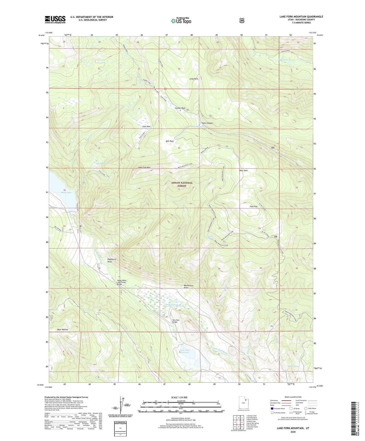
2020 topographic map quadrangle Lake Fork Mountain in the state of Utah. Scale: 1:24000. Based on the newly updated USGS 7.5' US Topo map series, this map is in the following counties: Duchesne. The map contains contour data, water features, and other items you are used to seeing on USGS maps, but also has updated roads and other features. This is the next generation of topographic maps. Printed on high-quality waterproof paper with UV fade-resistant inks.
Quads adjacent to this one:
West: Kidney Lake
Northwest: Oweep Creek
North: Garfield Basin
Northeast: Mount Emmons
East: Burnt Mill Spring
Southeast: Altonah
South: Mountain Home
Southwest: Dry Mountain
Contains the following named places: Bear Park, Bear Wallow, Beaver Dam Campground, Center Park, Cow Park, Fish Creek, Fish Creek National Recreation Trail, Fisher Ranch, Flea Flat, Lake Fork Corral, Lake Fork Mountain, Little Meadow, Long Park, Mackentire Draw, McKune Spring, Mill Park, Mill Spring, Moon Lake Dam, Moon Lake Resort, Mule Creek, Raspberry Draw, Transfer Spring, Twin Pats Bridge, Twin Pots Dam, Twin Pots Reservoir, Upper Moon Lake Canal Bridge