MyTopo
Laketown Utah US Topo Map
Couldn't load pickup availability
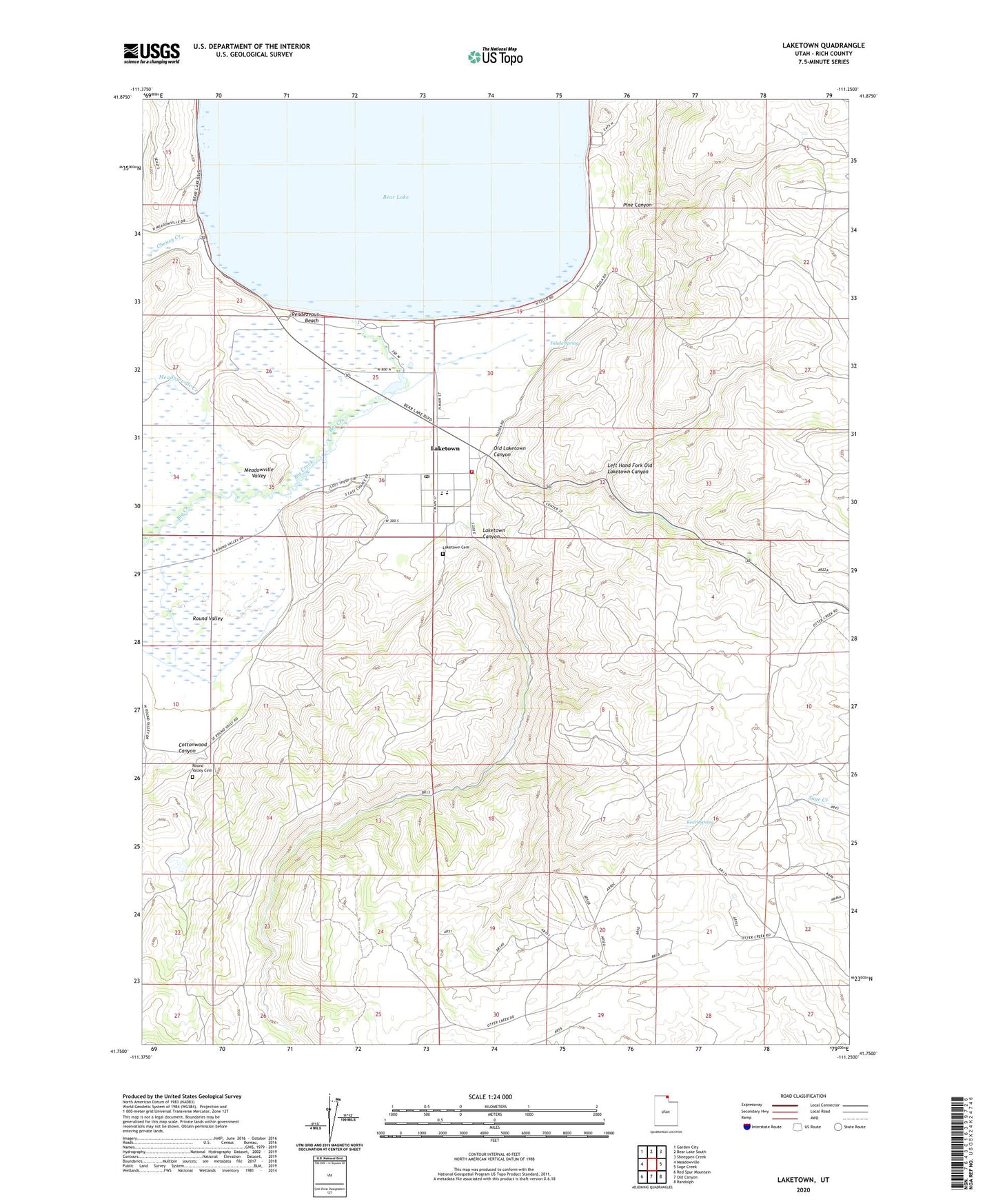
2020 topographic map quadrangle Laketown in the state of Utah. Scale: 1:24000. Based on the newly updated USGS 7.5' US Topo map series, this map is in the following counties: Rich. The map contains contour data, water features, and other items you are used to seeing on USGS maps, but also has updated roads and other features. This is the next generation of topographic maps. Printed on high-quality waterproof paper with UV fade-resistant inks.
Quads adjacent to this one:
West: Meadowville
Northwest: Garden City
North: Bear Lake South
Northeast: Sheeppen Creek
East: Sage Creek
Southeast: Randolph
South: Old Canyon
Southwest: Red Spur Mountain
Contains the following named places: Bear Lake Rendezvous Beach Campground, Big Creek, Cheney Creek, Cottonwood Canyon, Falula Spring, Garden City-Laketown Division, Kearl Spring, Laketown, Laketown Canyon, Laketown Cemetery, Laketown Fire Department, Laketown Post Office, Left Hand Fork Old Laketown Canyon, Meadowville Creek, Meadowville Valley, North Rich Elementary School, Old Laketown Canyon, Pine Canyon, Rendezvous Beach, Rendezvous Beach State Park, Rich County Ambulance Mobile Unit - Laketown, Round Valley, Round Valley Cemetery, The Church of Jesus Christ of Latter Day Saints, Town of Laketown