MyTopo
Sheeppen Creek Utah US Topo Map
Couldn't load pickup availability
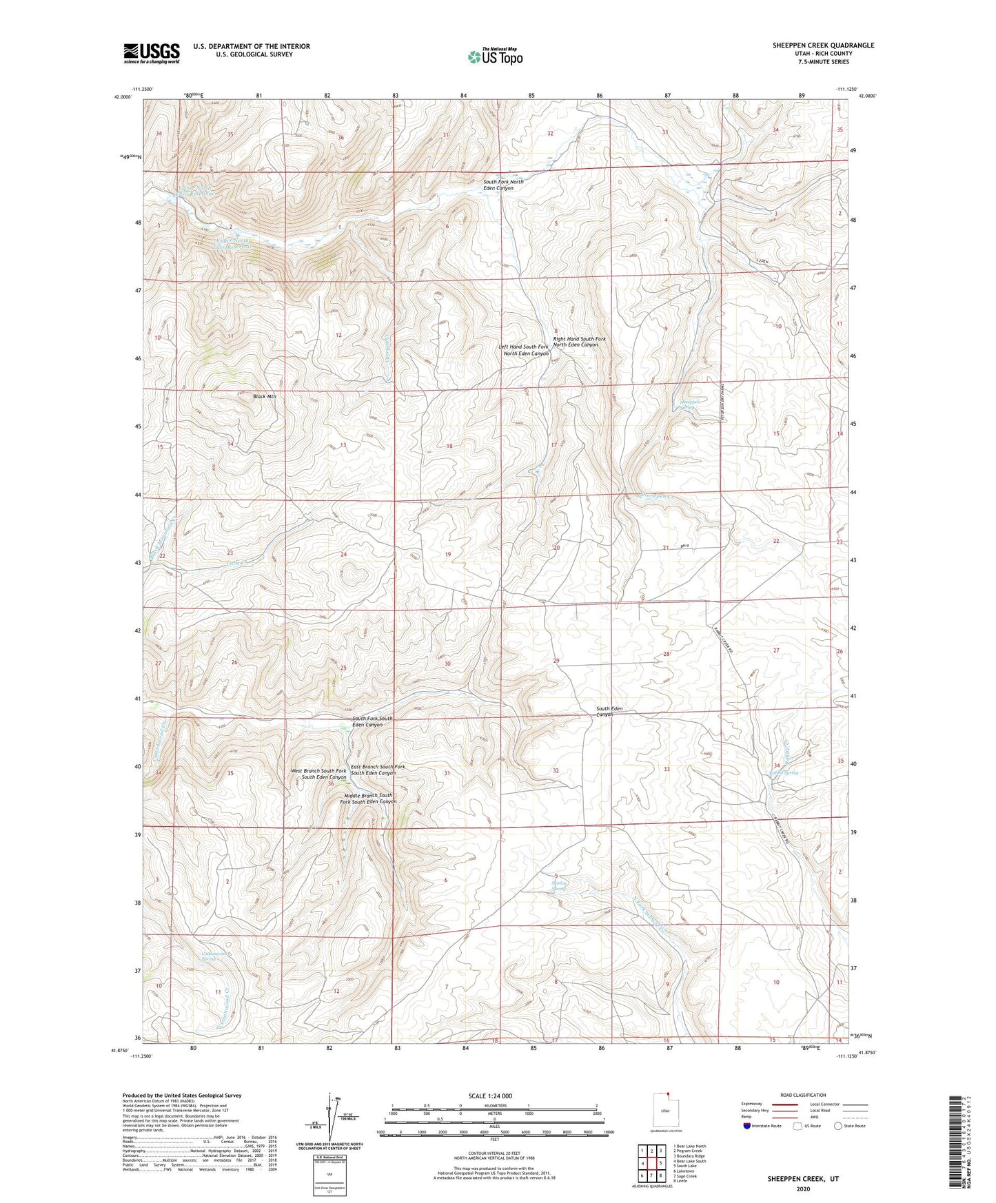
2023 topographic map quadrangle Sheeppen Creek in the state of Utah. Scale: 1:24000. Based on the newly updated USGS 7.5' US Topo map series, this map is in the following counties: Rich. The map contains contour data, water features, and other items you are used to seeing on USGS maps, but also has updated roads and other features. This is the next generation of topographic maps. Printed on high-quality waterproof paper with UV fade-resistant inks.
Quads adjacent to this one:
West: Bear Lake South
Northwest: Bear Lake North
North: Pegram Creek
Northeast: Boundary Ridge
East: South Lake
Southeast: Leefe
South: Sage Creek
Southwest: Laketown
This map covers the same area as the classic USGS quad with code o41111h2.
Contains the following named places: Black Mountain, Black Mountain Creek, Cottonwood Creek, Cottonwood Spring, Currant Creek, East Branch South Fork South Eden Canyon, Left Hand South Fork North Eden Canyon, Lower North Eden Reservoir, Middle Branch South Fork South Eden Canyon, Rabbit Spring, Right Hand South Fork North Eden Canyon, Sheeppen Creek, Sheeppen Spring, Shirley Spring, South Eden Reservoir, South Fork North Eden Canyon, South Fork South Eden Canyon, Upper North Eden Reservoir, West Branch South Fork South Eden Canyon