MyTopo
Minnie Maud Creek West Utah US Topo Map
Couldn't load pickup availability
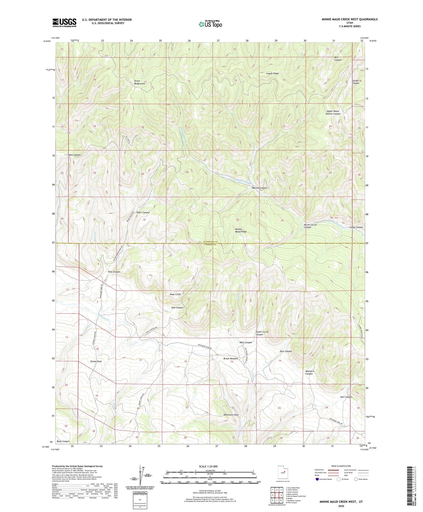
2023 topographic map quadrangle Minnie Maud Creek West in the state of Utah. Scale: 1:24000. Based on the newly updated USGS 7.5' US Topo map series, this map is in the following counties: Duchesne, Carbon. The map contains contour data, water features, and other items you are used to seeing on USGS maps, but also has updated roads and other features. This is the next generation of topographic maps. Printed on high-quality waterproof paper with UV fade-resistant inks.
Quads adjacent to this one:
West: Matts Summit
Northwest: Gray Head Peak
North: Jones Hollow
Northeast: Lance Canyon
East: Minnie Maud Creek East
Southeast: Pine Canyon
South: Deadman Canyon
Southwest: Helper
This map covers the same area as the classic USGS quad with code o39110g6.
Contains the following named places: Antone Creek, Argyle Ridge, Brook Meadow, Colby Canyon, Dry Fork, Earl Canyon, East Canyon, Left Fork Summit Creek, Maynard Canyon, Minnie Maud Ridge, North Corral Canyon, Orson Bedground, Pearl Canyon, Pole Canyon, Right Fork Summit Creek, Roan Cliffs, Sam Canyon, South Corral Canyon, Warren Canyon, West Canyon