MyTopo
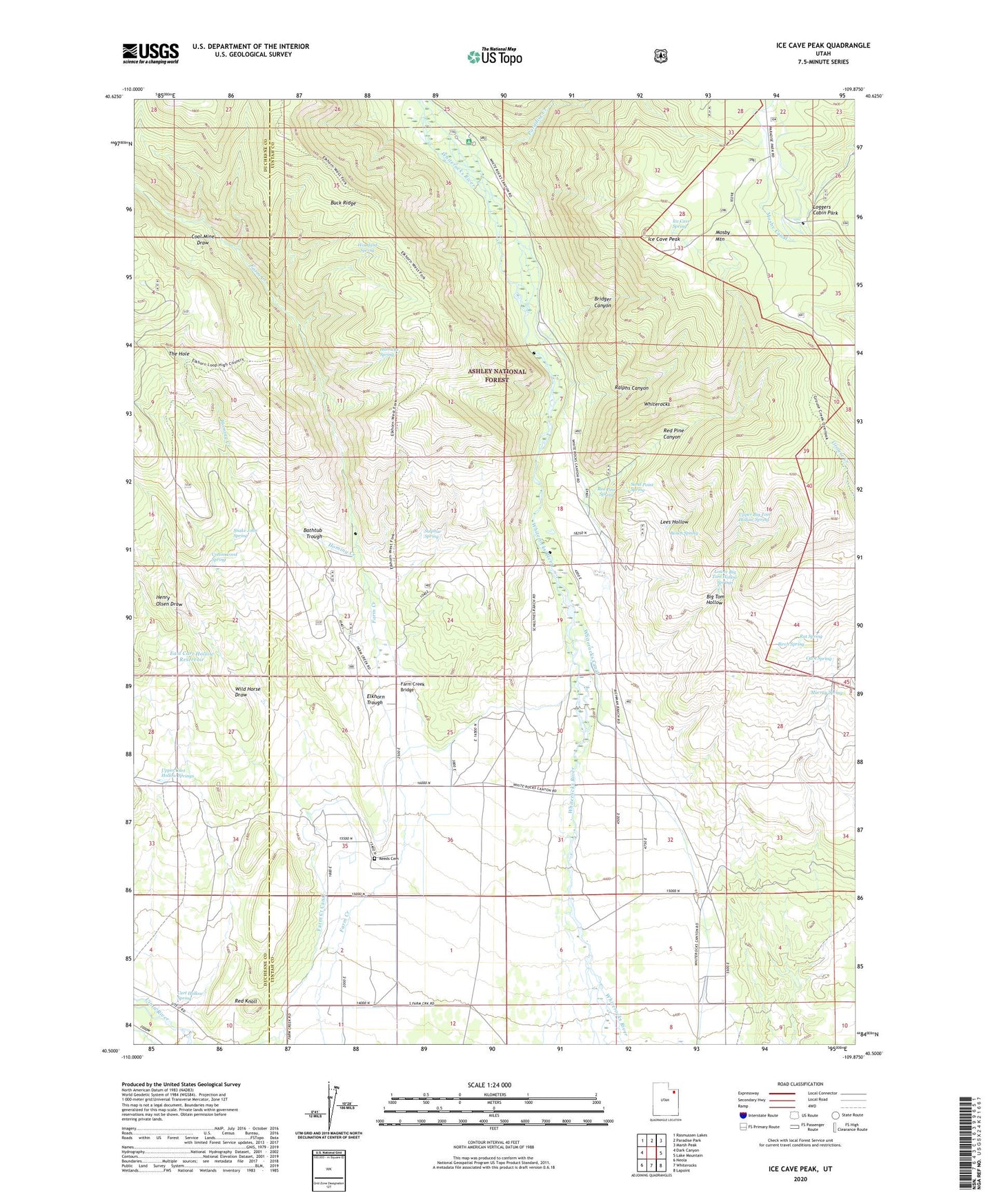
Ice Cave Peak Utah US Topo Map
Couldn't load pickup availability
Also explore the Ice Cave Peak Forest Service Topo of this same quad for updated USFS data
2023 topographic map quadrangle Ice Cave Peak in the state of Utah. Scale: 1:24000. Based on the newly updated USGS 7.5' US Topo map series, this map is in the following counties: Uintah, Duchesne. The map contains contour data, water features, and other items you are used to seeing on USGS maps, but also has updated roads and other features. This is the next generation of topographic maps. Printed on high-quality waterproof paper with UV fade-resistant inks.
Quads adjacent to this one:
West: Dark Canyon
Northwest: Rasmussen Lakes
North: Paradise Park
Northeast: Marsh Peak
East: Lake Mountain
Southeast: Lapoint
South: Whiterocks
Southwest: Neola
This map covers the same area as the classic USGS quad with code o40109e8.
Contains the following named places: Bathtub Trough, Bench Spring, Big Tom Hollow, Birch Spring, Bridger Canyon, Bull Pasture, Cart Hollow Spring, Coal Mine Draw, Cottonwood Spring, Cuch Spring, East Cart Hollow Reservoir, Elkhorn Guard Station, Elkhorn Trough, Farm Creek Bridge, Farm Creek Canal, Farm Creek Grazing Enclosure, Henry Olsen Draw, Hominy Creek, Horricks Spring, Ice Cave Peak, Ice Cave Spring, Lees Hollow, Loggers Cabin Park, Lower Big Tom Hollow Springs, Mosby Mountain, Murray Spring, Paradise Creek, Ralphs Canyon, Rat Spring, Red Knoll, Red Pine Canyon, Red Pine Spring, Reeds Cemetery, Sand Point Spring, Snake John Spring, Sulphur Spring, The Hole, Upper Big Tom Hollow Spring, Upper Cart Hollow Springs, Whiterocks, Whiterocks Campground, Whiterocks Canal, Wild Horse Draw, Woodard Spring, ZIP Code: 84085