MyTopo
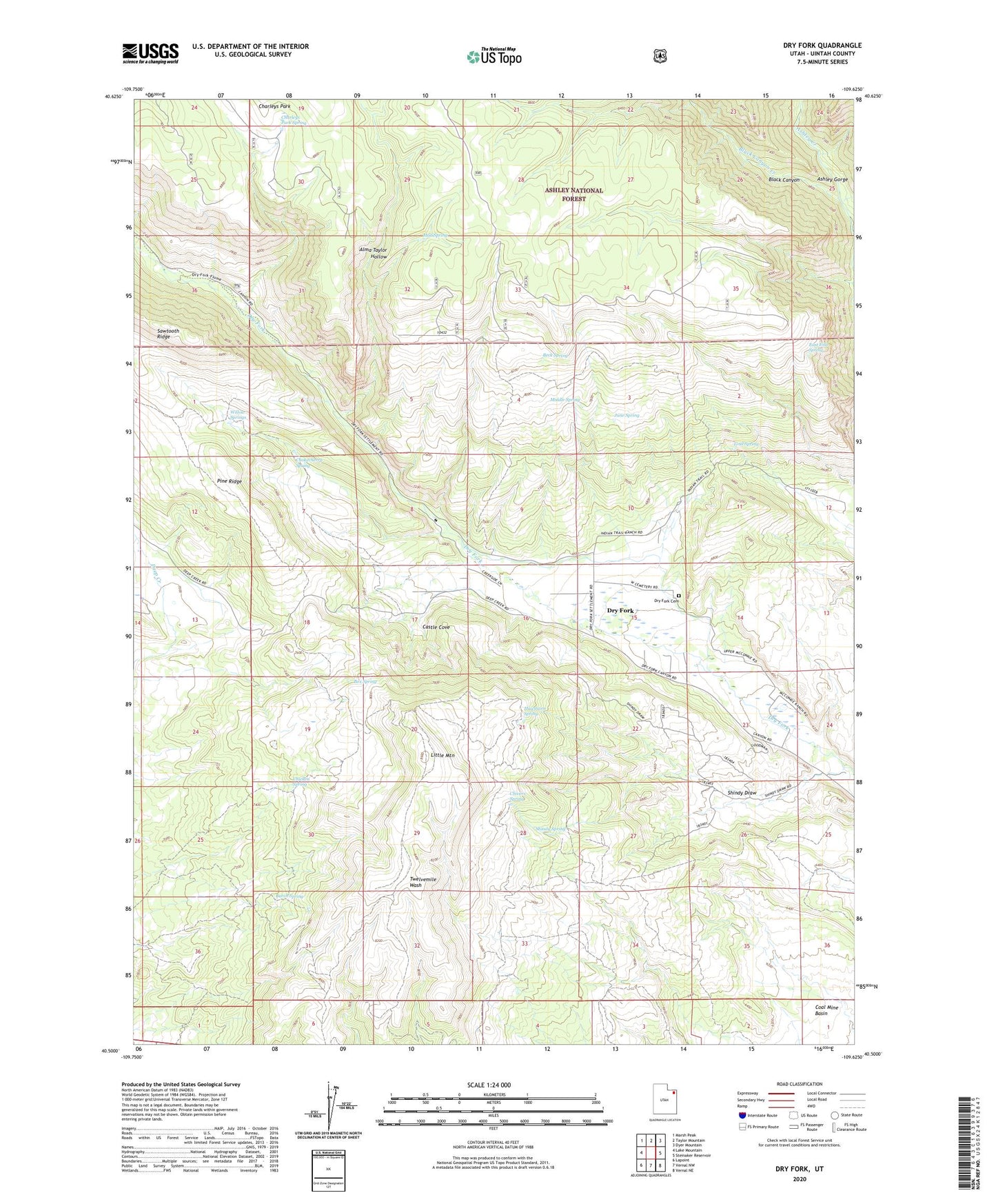
Dry Fork Utah US Topo Map
Couldn't load pickup availability
Also explore the Dry Fork Forest Service Topo of this same quad for updated USFS data
2023 topographic map quadrangle Dry Fork in the state of Utah. Scale: 1:24000. Based on the newly updated USGS 7.5' US Topo map series, this map is in the following counties: Uintah. The map contains contour data, water features, and other items you are used to seeing on USGS maps, but also has updated roads and other features. This is the next generation of topographic maps. Printed on high-quality waterproof paper with UV fade-resistant inks.
Quads adjacent to this one:
West: Lake Mountain
Northwest: Marsh Peak
North: Taylor Mountain
Northeast: Dyer Mountain
East: Steinaker Reservoir
Southeast: Vernal NE
South: Vernal NW
Southwest: Lapoint
This map covers the same area as the classic USGS quad with code o40109e6.
Contains the following named places: Alma Taylor Hollow, Beck Spring, Black Canyon, Black Canyon Creek, Box Spring, Burch Spring, Castle Cove, Charleys Park, Charleys Park Spring, Chicken Spring, Chivers Spring, Chokecherry Spring, Dry Fork, Dry Fork Cemetery, Dry Fork Picnic Site, East End Spring, Hawthorn Spring, June Spring, Lind Spring, Little Mountain, Little Mountain Overlook, Middle Spring, Mud Spring, Pine Ridge, Pine Ridge Picnic Site, Shindy Draw, Shindy Hollow Picnic Site, Shindy Spring, Willow Springs