MyTopo
Leidy Peak Utah US Topo Map
Couldn't load pickup availability
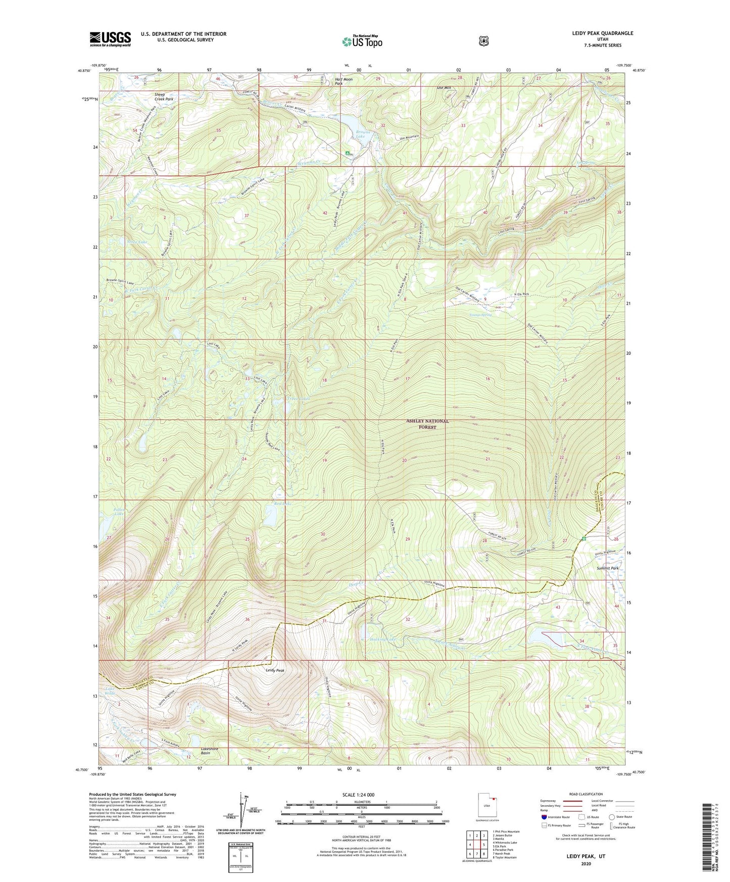
2020 topographic map quadrangle Leidy Peak in the state of Utah. Scale: 1:24000. Based on the newly updated USGS 7.5' US Topo map series, this map is in the following counties: Daggett, Uintah. The map contains contour data, water features, and other items you are used to seeing on USGS maps, but also has updated roads and other features. This is the next generation of topographic maps. Printed on high-quality waterproof paper with UV fade-resistant inks.
Quads adjacent to this one:
West: Whiterocks Lake
Northwest: Phil Pico Mountain
North: Jessen Butte
Northeast: Manila
East: Elk Park
Southeast: Taylor Mountain
South: Marsh Peak
Southwest: Paradise Park
Contains the following named places: Beaver Creek, Brown Lake Campground, Browne Lake, Browne Lake Dam, East Fork Carter Creek, Hacking Lake, Icy Hill Dugway, Lakeshore Basin, Leidy Peak, Long Park Dam, Long Park Reservoir, Lost Lake, Lost Spring, Middle Fork Carter Creek, Old Carter Trail Historical marker, Pollen Lake, Red Lake, Stove Lake, Summit Park, Tepee Lakes, Ute Mountain, West Fork Carter Creek, Weyman Creek, Youngs Spring