MyTopo
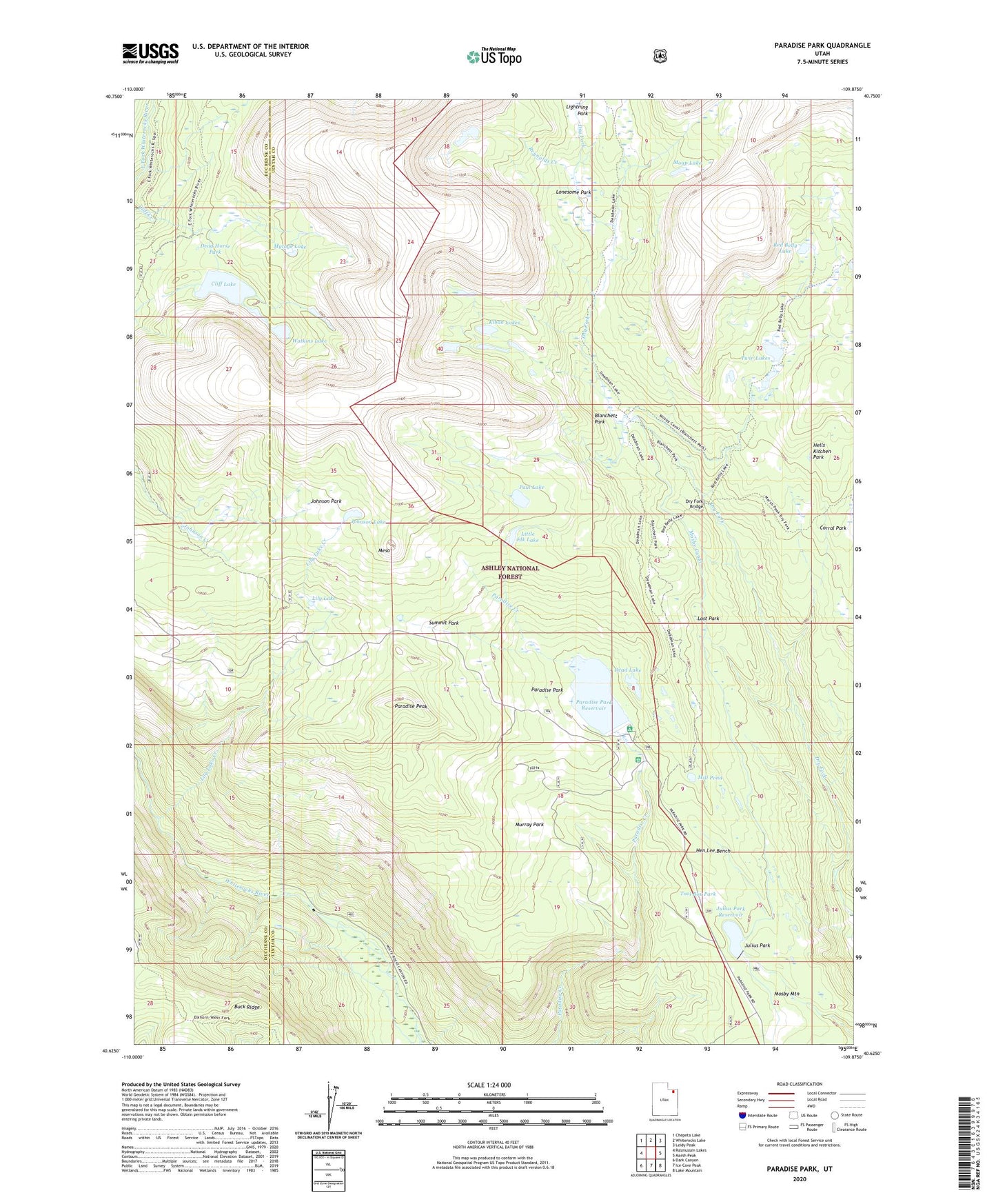
Paradise Park Utah US Topo Map
Couldn't load pickup availability
Also explore the Paradise Park Forest Service Topo of this same quad for updated USFS data
2023 topographic map quadrangle Paradise Park in the state of Utah. Scale: 1:24000. Based on the newly updated USGS 7.5' US Topo map series, this map is in the following counties: Uintah, Duchesne. The map contains contour data, water features, and other items you are used to seeing on USGS maps, but also has updated roads and other features. This is the next generation of topographic maps. Printed on high-quality waterproof paper with UV fade-resistant inks.
Quads adjacent to this one:
West: Rasmussen Lakes
Northwest: Chepeta Lake
North: Whiterocks Lake
Northeast: Leidy Peak
East: Marsh Peak
Southeast: Lake Mountain
South: Ice Cave Peak
Southwest: Dark Canyon
This map covers the same area as the classic USGS quad with code o40109f8.
Contains the following named places: Blanchett Park, Buck Ridge, Cliff Lake, Cliff Lake Dam, Dead Horse Park, Dead Lake, Dry Fork Bridge, Dry Fork Trail, Hells Kitchen Park, Hen Lee Bench, Johnson Lake, Johnson Park, Julius Park, Julius Park Dam, Julius Park Reservoir, Kibah Lakes, Lightning Park, Lily Lake, Lily Lake Creek, Little Elk Lake, Lonesome Park, Lost Park, Mesa, Mill Pond, Moap Lake, Mosby Canal, Murray Park, Mytoge Lake, Paradise Campground, Paradise Guard Station, Paradise Park, Paradise Park Dam, Paradise Park Reservoir, Paradise Peak, Paul Lake, Red Belly Lake, Reynolds Creek, Summit Park, Tool Box Park, Twin Lakes, Watkins Lake