MyTopo
Long Valley Junction Utah US Topo Map
Couldn't load pickup availability
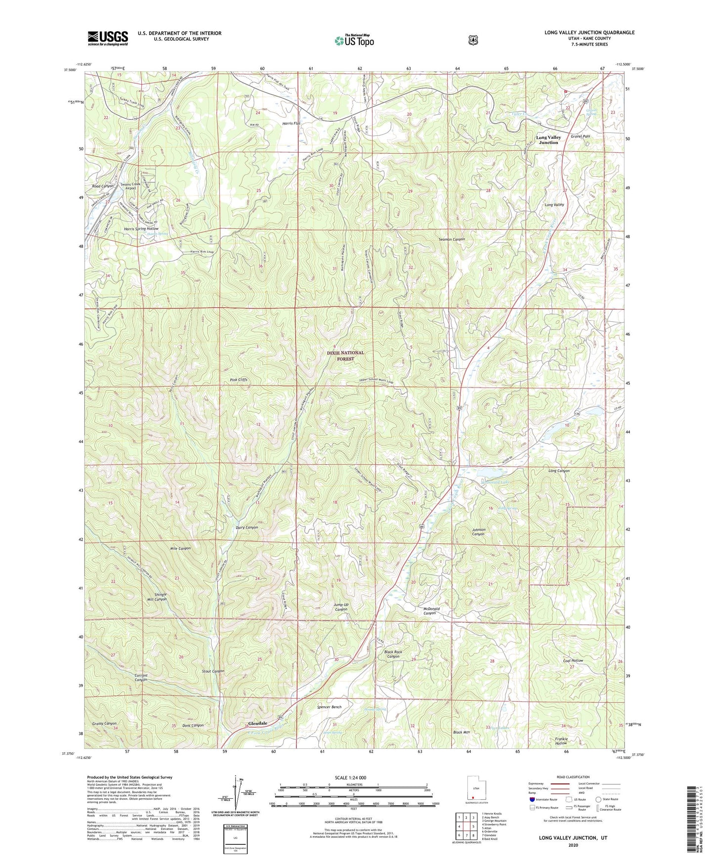
2020 topographic map quadrangle Long Valley Junction in the state of Utah. Scale: 1:24000. Based on the newly updated USGS 7.5' US Topo map series, this map is in the following counties: Kane. The map contains contour data, water features, and other items you are used to seeing on USGS maps, but also has updated roads and other features. This is the next generation of topographic maps. Printed on high-quality waterproof paper with UV fade-resistant inks.
Quads adjacent to this one:
West: Strawberry Point
Northwest: Henrie Knolls
North: Asay Bench
Northeast: George Mountain
East: Alton
Southeast: Bald Knoll
South: Glendale
Southwest: Orderville
Contains the following named places: Billingsly Creek, Black Mountain, Black Rock Canyon, Cedar Mountain Fire Protection District Statiion 2, Currant Canyon, Dairy Canyon, Dons Canyon, Flax Lakes, Golley, Gravel Pass, Gravel Spring, Harris Flat, Harris Spring, Harris Spring Hollow, Hops Spring, Howdy Spring, Johnson Canyon, Jolly Spring, Jump-Up Canyon, Le Vanger Lakes, Long Canyon, Long Valley Junction, McDonald Canyon, McDonald Lake, Mile Canyon, Minnie Creek, Road Canyon, School Wash, Seaman Canyon, Shingle Mill Canyon, Spencer Bench, Stout Canyon, Swains Creek Airport, Town of Alton, Tyler Creek