MyTopo
Bald Knoll Utah US Topo Map
Couldn't load pickup availability
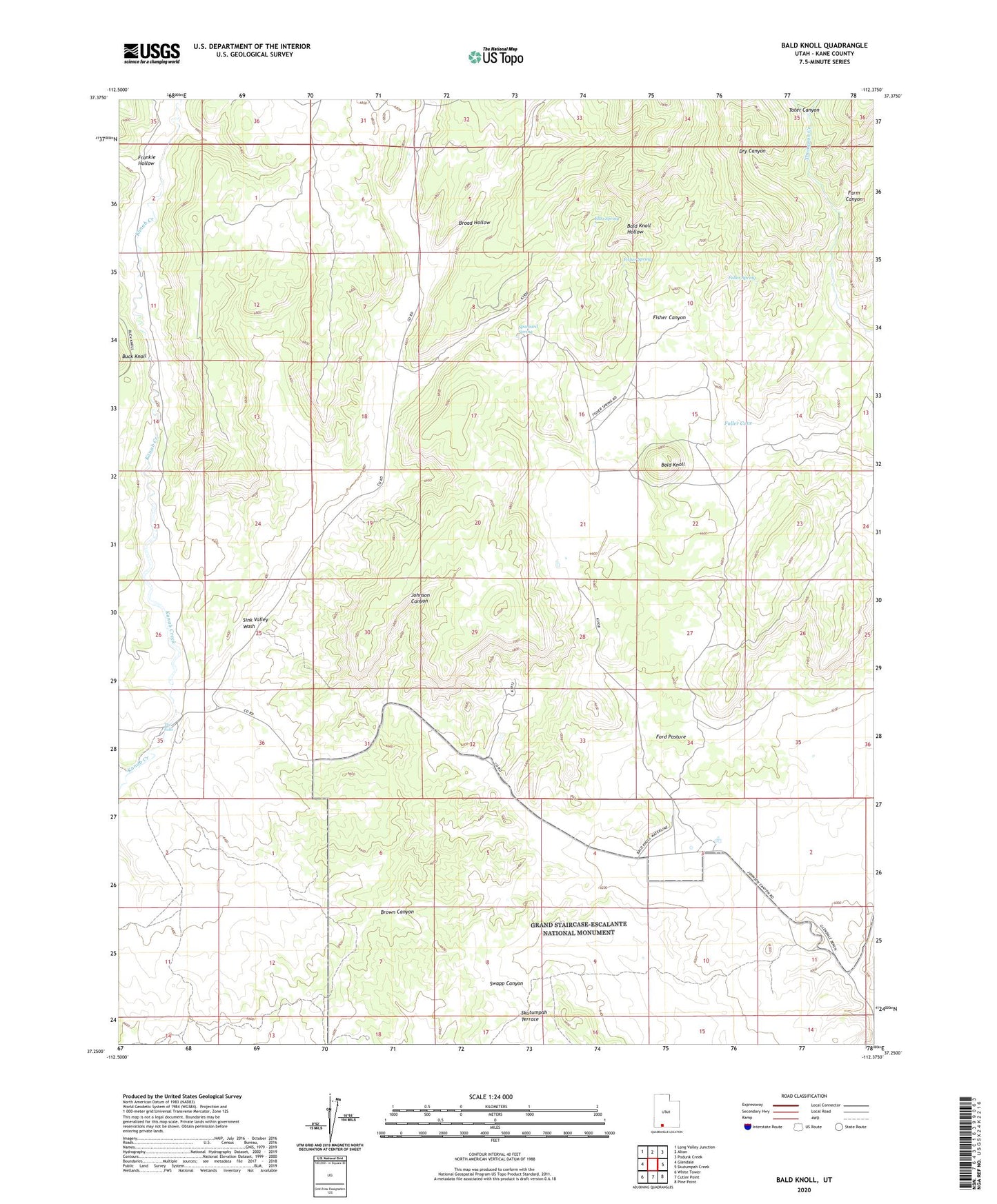
2023 topographic map quadrangle Bald Knoll in the state of Utah. Scale: 1:24000. Based on the newly updated USGS 7.5' US Topo map series, this map is in the following counties: Kane. The map contains contour data, water features, and other items you are used to seeing on USGS maps, but also has updated roads and other features. This is the next generation of topographic maps. Printed on high-quality waterproof paper with UV fade-resistant inks.
Quads adjacent to this one:
West: Glendale
Northwest: Long Valley Junction
North: Alton
Northeast: Podunk Creek
East: Skutumpah Creek
Southeast: Pine Point
South: Cutler Point
Southwest: White Tower
This map covers the same area as the classic USGS quad with code o37112c4.
Contains the following named places: Bald Knoll, Broad Hollow, Dry Canyon, Elbo Spring, Farm Canyon, Fisher Canyon, Fisher Spring, Ford Pasture, Frankie Hollow, Fuller Cove, Fuller Spring, Sink Valley Wash, Spaniard Spring, Tater Canyon, The Falls