MyTopo
Mayfield Utah US Topo Map
Couldn't load pickup availability
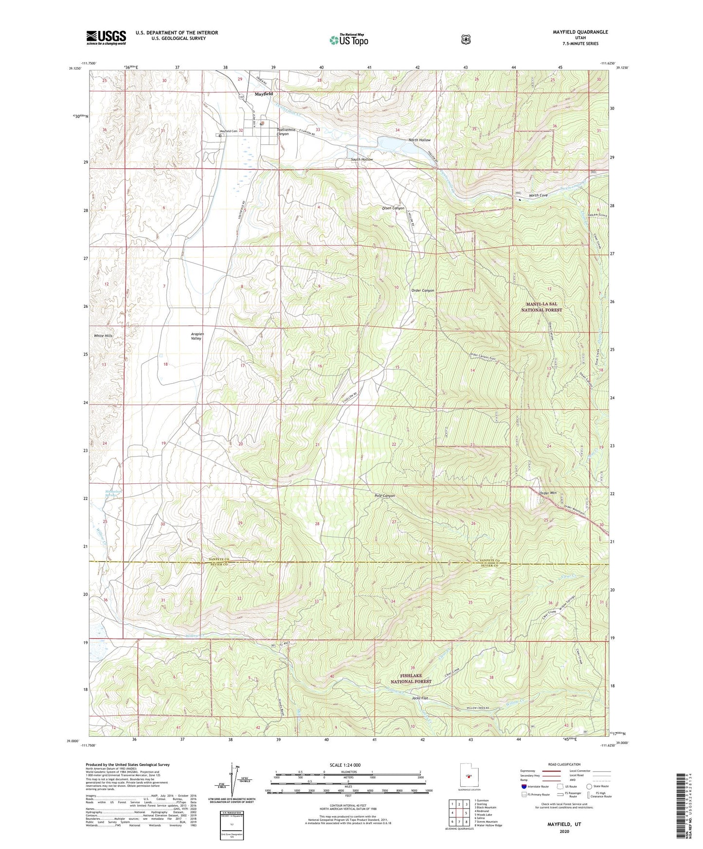
2020 topographic map quadrangle Mayfield in the state of Utah. Scale: 1:24000. Based on the newly updated USGS 7.5' US Topo map series, this map is in the following counties: Sanpete, Sevier. The map contains contour data, water features, and other items you are used to seeing on USGS maps, but also has updated roads and other features. This is the next generation of topographic maps. Printed on high-quality waterproof paper with UV fade-resistant inks.
Quads adjacent to this one:
West: Redmond
Northwest: Gunnison
North: Sterling
Northeast: Black Mountain
East: Woods Lake
Southeast: Water Hollow Ridge
South: Steves Mountain
Southwest: Salina
Contains the following named places: Clear Creek, Jacks Creek, Jacks Flat, Mayfield, Mayfield Cemetery, Mayfield Face Wildlife Management Area, Mayfield Post Office, Michaelson Springs, Mill Creek, North Cove, North Hollow, North Pine Creek, Olsen Canyon, Order Canyon, Order Mountain, Pole Canyon, South Hollow, South Pine Creek, The Church of Jesus Christ of Latter Day Saints, Town of Mayfield, Twelvemile Canyon, White Hills, Willow Creek Wildlife Management Area, ZIP Code: 84643