MyTopo
Fivemile Pass Utah US Topo Map
Couldn't load pickup availability
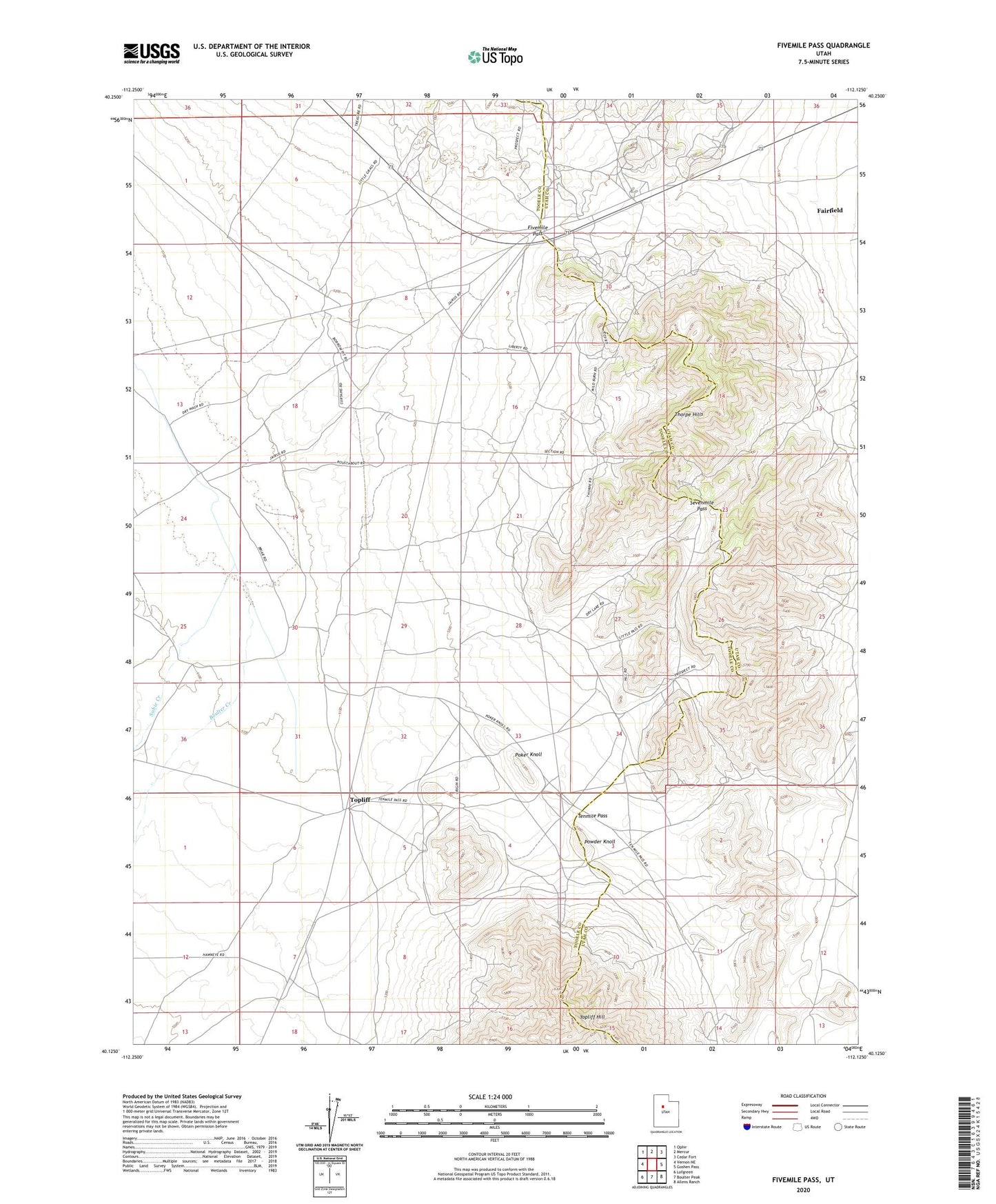
2023 topographic map quadrangle Fivemile Pass in the state of Utah. Scale: 1:24000. Based on the newly updated USGS 7.5' US Topo map series, this map is in the following counties: Tooele, Utah. The map contains contour data, water features, and other items you are used to seeing on USGS maps, but also has updated roads and other features. This is the next generation of topographic maps. Printed on high-quality waterproof paper with UV fade-resistant inks.
Quads adjacent to this one:
West: Vernon NE
Northwest: Ophir
North: Mercur
Northeast: Cedar Fort
East: Goshen Pass
Southeast: Allens Ranch
South: Boulter Peak
Southwest: Lofgreen
This map covers the same area as the classic USGS quad with code o40112b2.
Contains the following named places: Boulter Creek, Fivemile Pass, Poker Knoll, Powder Knoll, Sabie Creek, Sevenmile Pass, Tenmile Pass, Thorpe Hills, Topliff, Topliff Hill