MyTopo
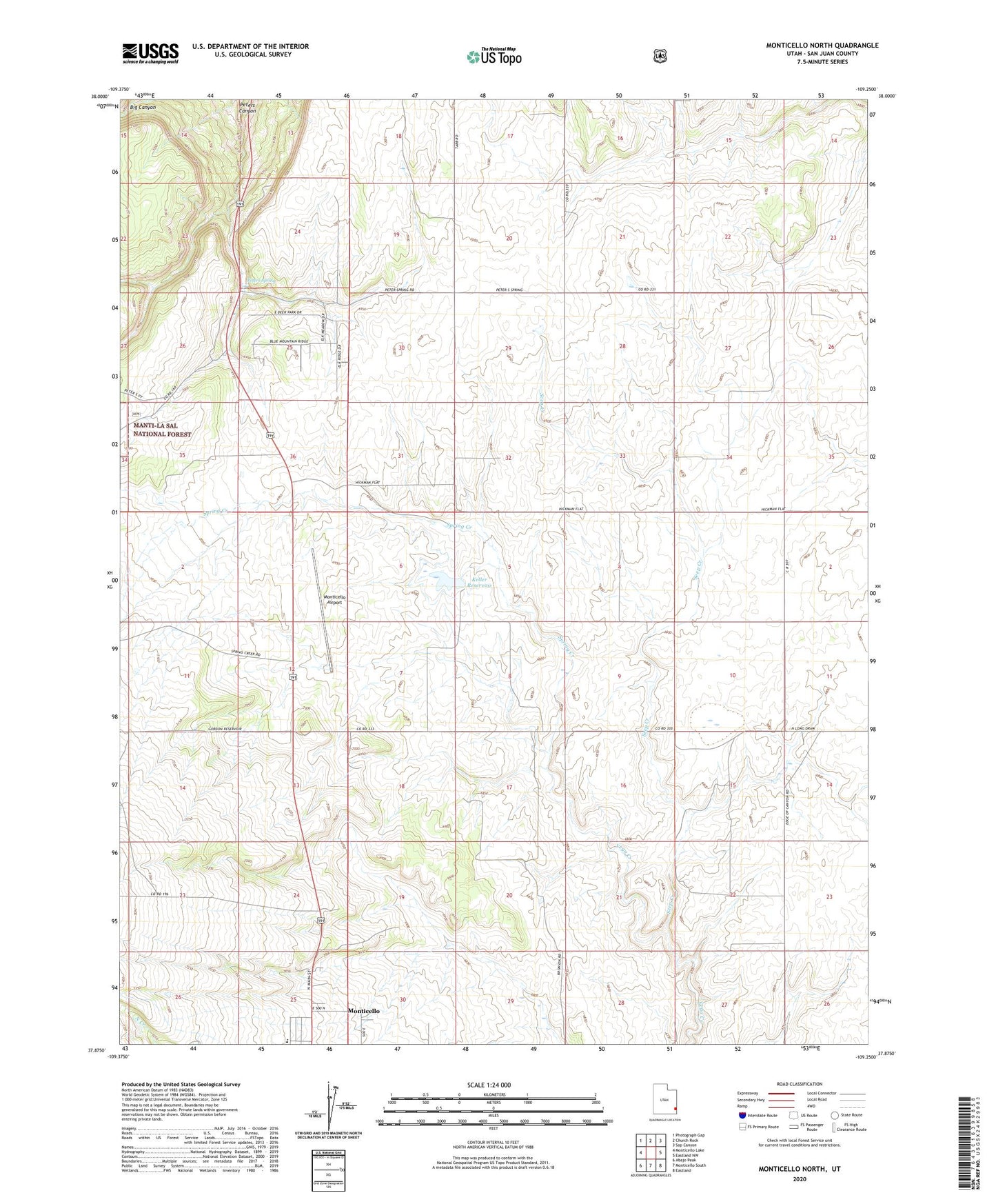
Monticello North Utah US Topo Map
Couldn't load pickup availability
Also explore the Monticello North Forest Service Topo of this same quad for updated USFS data
2023 topographic map quadrangle Monticello North in the state of Utah. Scale: 1:24000. Based on the newly updated USGS 7.5' US Topo map series, this map is in the following counties: San Juan. The map contains contour data, water features, and other items you are used to seeing on USGS maps, but also has updated roads and other features. This is the next generation of topographic maps. Printed on high-quality waterproof paper with UV fade-resistant inks.
Quads adjacent to this one:
West: Monticello Lake
Northwest: Photograph Gap
North: Church Rock
Northeast: Sop Canyon
East: Eastland NW
Southeast: Eastland
South: Monticello South
Southwest: Abajo Peak
This map covers the same area as the classic USGS quad with code o37109h3.
Contains the following named places: Bankhead Creek, First Southern Baptist Church, Keller Dam, Keller Reservoir, Monticello Airport, Monticello Elementary School, Mountain View Trailer Park, Peters Spring, Rowleys Trailer Park, Seep Creek, Spring Creek