MyTopo
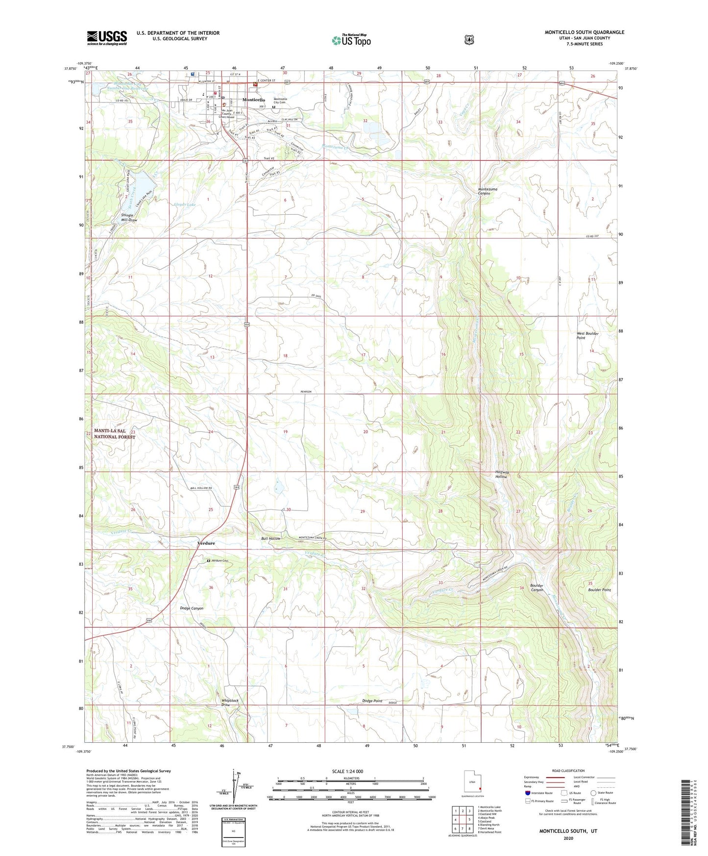
Monticello South Utah US Topo Map
Couldn't load pickup availability
Also explore the Monticello South Forest Service Topo of this same quad for updated USFS data
2023 topographic map quadrangle Monticello South in the state of Utah. Scale: 1:24000. Based on the newly updated USGS 7.5' US Topo map series, this map is in the following counties: San Juan. The map contains contour data, water features, and other items you are used to seeing on USGS maps, but also has updated roads and other features. This is the next generation of topographic maps. Printed on high-quality waterproof paper with UV fade-resistant inks.
Quads adjacent to this one:
West: Abajo Peak
Northwest: Monticello Lake
North: Monticello North
Northeast: Eastland NW
East: Eastland
Southeast: Horsehead Point
South: Devil Mesa
Southwest: Blanding North
This map covers the same area as the classic USGS quad with code o37109g3.
Contains the following named places: Baker Ranger Station, Boulder Canyon, Boulder Creek, Bull Hollow, City of Monticello, Dodge Point, Halfway Hollow, Lloyds Lake, Monticello, Monticello City Cemetery, Monticello City Number One Dam, Monticello City Number One Reservoir, Monticello District Ranger Office, Monticello Fire Department, Monticello Golf Course, Monticello High School, Monticello Police Department, Monticello Post Office, North Creek, Pole Creek, Saint Josephs Catholic Church, San Juan Community Church, San Juan County Sheriff's Office, San Juan Emergency Medical Services - Monticello, San Juan Hospital, San Juan Hospital Heliport, Shingle Mill Draw, South Creek, The Church of Jesus Christ of Latter Day Saints, United States Forest Service Fire Station - Monticello Office, Utah Highway Patrol Section 13 Monticello Office, Vega Creek, Verdure, Verdure Cemetery, Verdure Creek, West Boulder Point, Westerner Trailer Park, Whipstock Draw