MyTopo
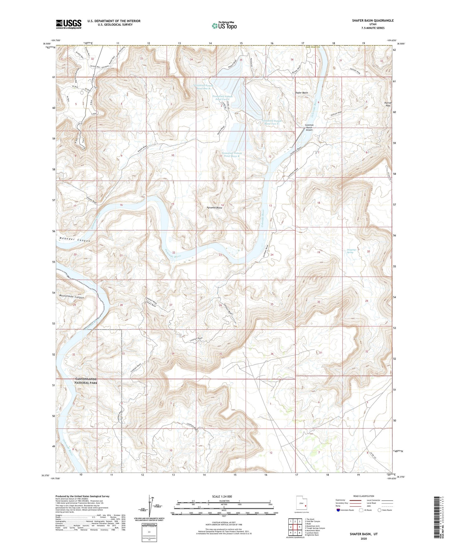
Shafer Basin Utah US Topo Map
Couldn't load pickup availability
2023 topographic map quadrangle Shafer Basin in the state of Utah. Scale: 1:24000. Based on the newly updated USGS 7.5' US Topo map series, this map is in the following counties: San Juan, Grand. The map contains contour data, water features, and other items you are used to seeing on USGS maps, but also has updated roads and other features. This is the next generation of topographic maps. Printed on high-quality waterproof paper with UV fade-resistant inks.
Quads adjacent to this one:
West: Musselman Arch
Northwest: The Knoll
North: Gold Bar Canyon
Northeast: Moab
East: Trough Springs Canyon
Southeast: Eightmile Rock
South: Lockhart Basin
Southwest: Monument Basin
This map covers the same area as the classic USGS quad with code o38109d6.
Contains the following named places: Anticline Campground, Anticline Overlook, Canyonlands Overlook, Caveman Ranch Airport, Dead Horse Point, Dead Horse Point Campground, Dead Horse Point Overlook, Dead Horse Point State Park Visitor Center, Dripping Spring, Frank Shafer Number 1 Oil Well, Hurrah Pass, J H Shafer Number 1 Oilwell, Little Bridge Canyon, Musselman Canyon, Pyramid Butte, Shafer Basin, TexasGulf Potash Pond One A, TexasGulf Potash Pond One A Dam, TexasGulf Potash Pond Three A, TexasGulf Potash Pond Three A Dam, TexasGulf Potash Pond Three B, TexasGulf Potash Pond Three B Dam, TexasGulf Potash Pond Two G, TexasGulf Potash Pond Two G Dam, TexasGulf Potash Pond Two N, TexasGulf Potash Pond Two N Dam, United Nations Tablet