MyTopo
Moon Bottom Utah US Topo Map
Couldn't load pickup availability
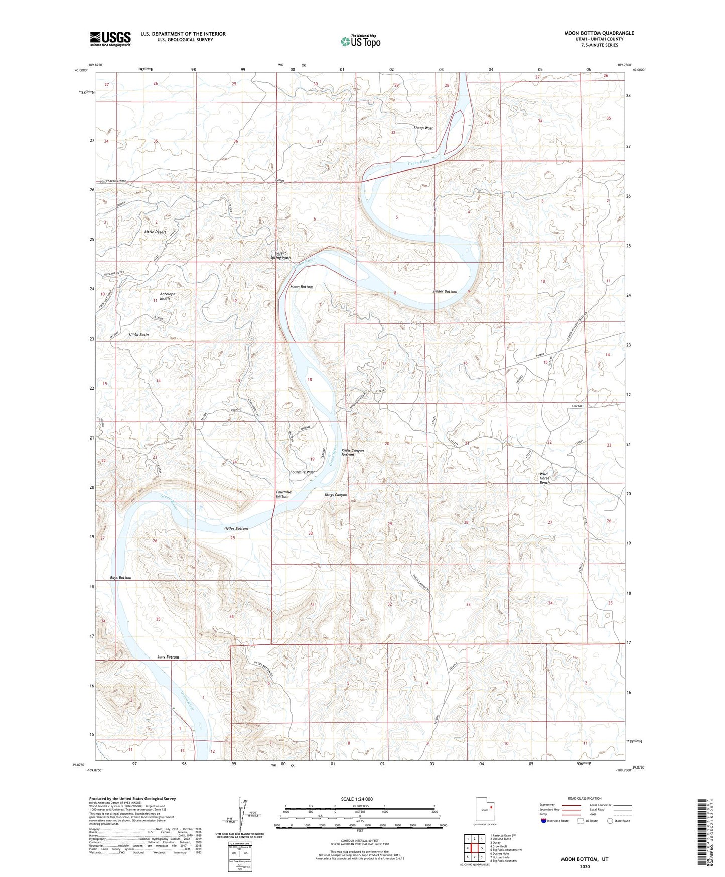
2023 topographic map quadrangle Moon Bottom in the state of Utah. Scale: 1:24000. Based on the newly updated USGS 7.5' US Topo map series, this map is in the following counties: Uintah. The map contains contour data, water features, and other items you are used to seeing on USGS maps, but also has updated roads and other features. This is the next generation of topographic maps. Printed on high-quality waterproof paper with UV fade-resistant inks.
Quads adjacent to this one:
West: Crow Knoll
Northwest: Pariette Draw SW
North: Uteland Butte
Northeast: Ouray
East: Big Pack Mountain NW
Southeast: Big Pack Mountain
South: Nutters Hole
Southwest: Duches Hole
This map covers the same area as the classic USGS quad with code o39109h7.
Contains the following named places: Antelope Knolls, Desert Spring Wash, Fourmile Bottom, Fourmile Wash, Hydes Bottom, Kings Canyon, Kings Canyon Bottom, Long Bottom, Moon Bottom, Rays Bottom, Sheep Wash, Snider Bottom, Wild Horse Bench