MyTopo
Ouray Utah US Topo Map
Couldn't load pickup availability
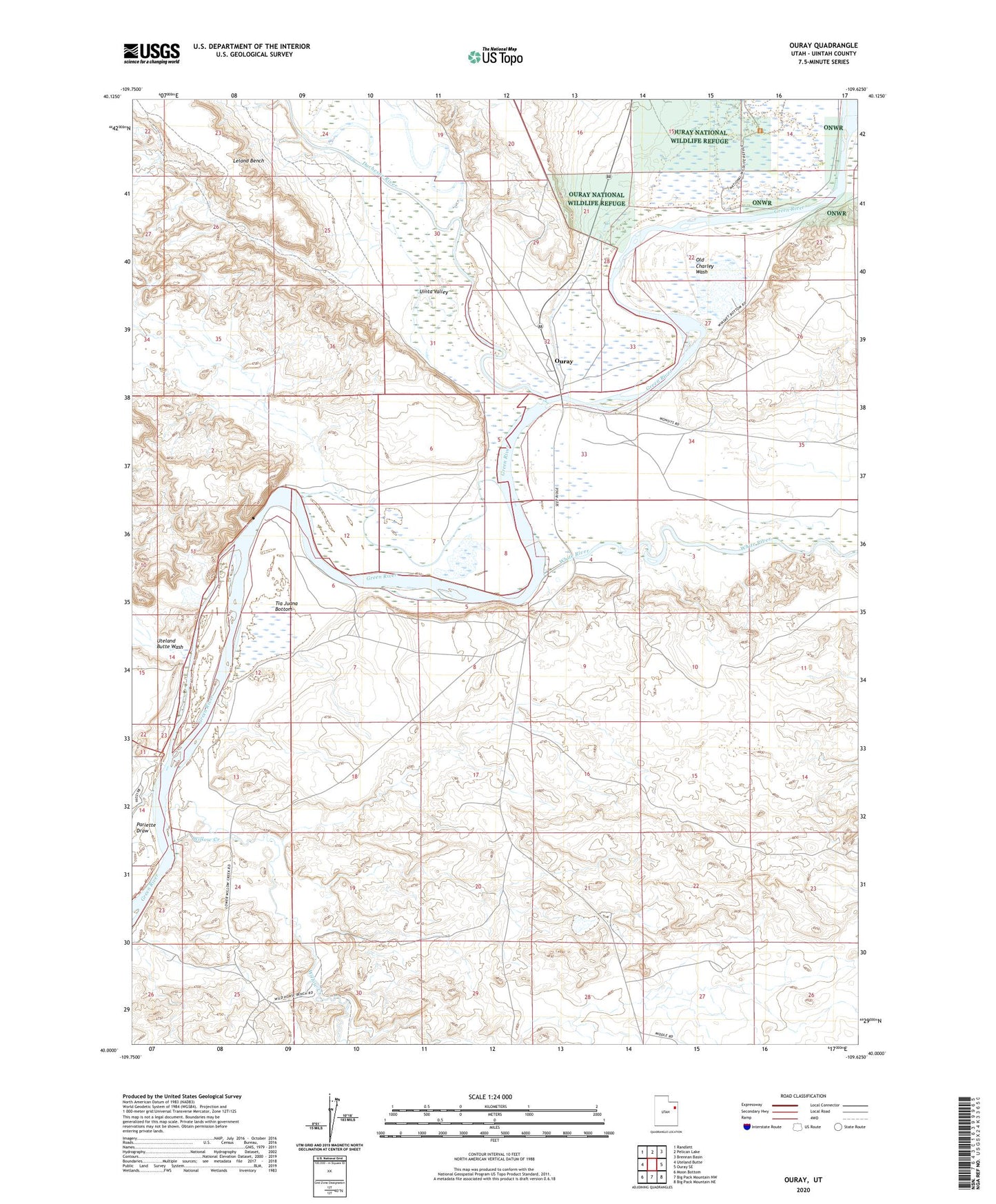
2023 topographic map quadrangle Ouray in the state of Utah. Scale: 1:24000. Based on the newly updated USGS 7.5' US Topo map series, this map is in the following counties: Uintah. The map contains contour data, water features, and other items you are used to seeing on USGS maps, but also has updated roads and other features. This is the next generation of topographic maps. Printed on high-quality waterproof paper with UV fade-resistant inks.
Quads adjacent to this one:
West: Uteland Butte
Northwest: Randlett
North: Pelican Lake
Northeast: Brennan Basin
East: Ouray SE
Southeast: Big Pack Mountain NE
South: Big Pack Mountain NW
Southwest: Moon Bottom
This map covers the same area as the classic USGS quad with code o40109a6.
Contains the following named places: Duchesne River, Old Charley Wash, Ouray, Pariette Draw, Tia Juana Bottom, Uinta Valley, Uteland Butte Wash, Uteland Mine, White River, Willow Creek