MyTopo
Big Pack Mountain NW Utah US Topo Map
Couldn't load pickup availability
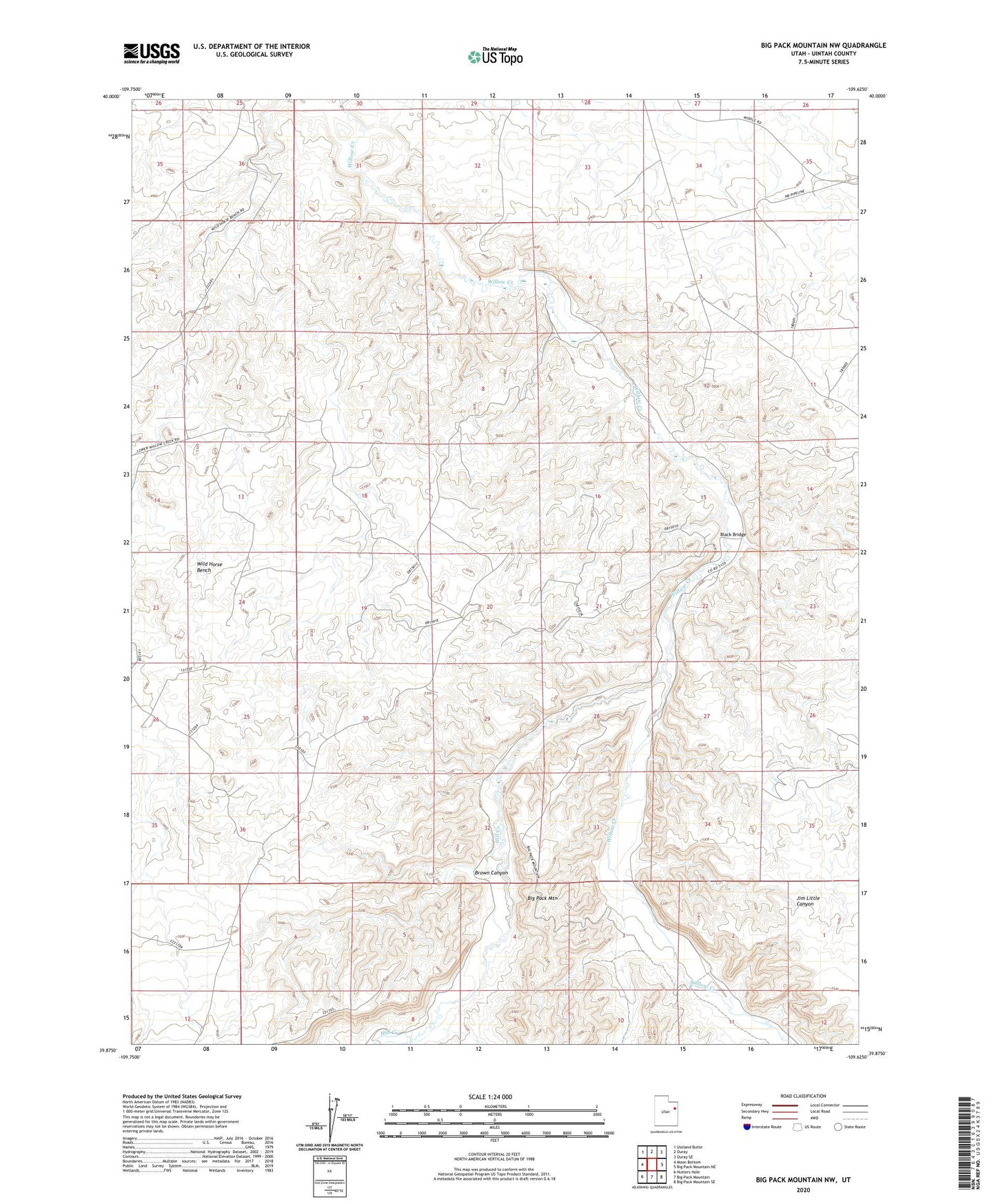
2023 topographic map quadrangle Big Pack Mountain NW in the state of Utah. Scale: 1:24000. Based on the newly updated USGS 7.5' US Topo map series, this map is in the following counties: Uintah. The map contains contour data, water features, and other items you are used to seeing on USGS maps, but also has updated roads and other features. This is the next generation of topographic maps. Printed on high-quality waterproof paper with UV fade-resistant inks.
Quads adjacent to this one:
West: Moon Bottom
Northwest: Uteland Butte
North: Ouray
Northeast: Ouray SE
East: Big Pack Mountain NE
Southeast: Big Pack Mountain SE
South: Big Pack Mountain
Southwest: Nutters Hole
This map covers the same area as the classic USGS quad with code o39109h6.
Contains the following named places: Black Bridge, Brown Canyon, Hill Creek, Island Gas Field, Jim Little Canyon, Squaw Crossing