MyTopo
Uteland Butte Utah US Topo Map
Couldn't load pickup availability
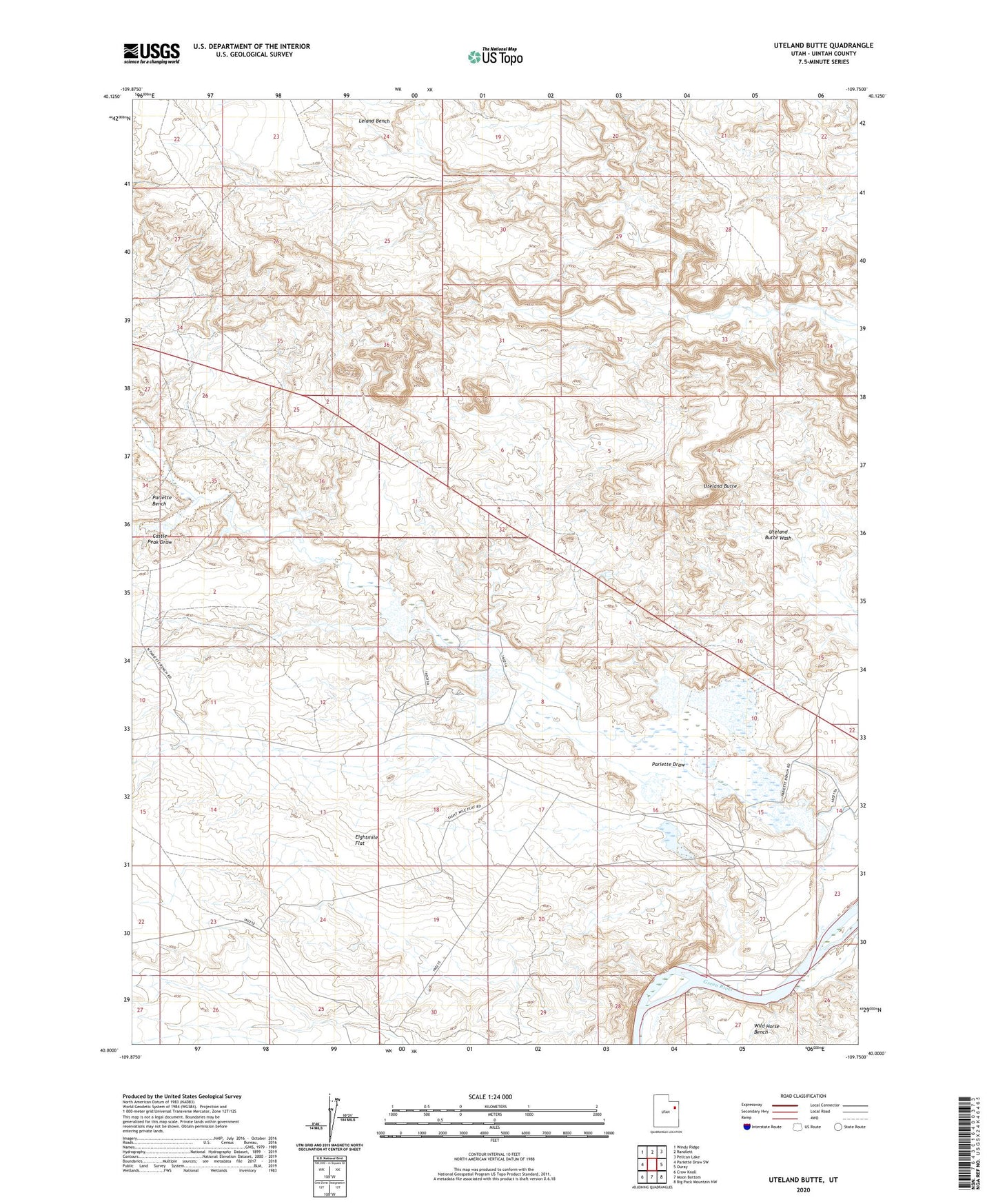
2023 topographic map quadrangle Uteland Butte in the state of Utah. Scale: 1:24000. Based on the newly updated USGS 7.5' US Topo map series, this map is in the following counties: Uintah. The map contains contour data, water features, and other items you are used to seeing on USGS maps, but also has updated roads and other features. This is the next generation of topographic maps. Printed on high-quality waterproof paper with UV fade-resistant inks.
Quads adjacent to this one:
West: Pariette Draw SW
Northwest: Windy Ridge
North: Randlett
Northeast: Pelican Lake
East: Ouray
Southeast: Big Pack Mountain NW
South: Moon Bottom
Southwest: Crow Knoll
This map covers the same area as the classic USGS quad with code o40109a7.
Contains the following named places: Castle Peak Draw, Pariette East Dike Dam, Pariette East Dike Reservoir, Pariette Flood Control Dam, Pariette Flood Control Reservoir, Pariette Waterfowl Habitat Management Area, Uteland Butte