MyTopo
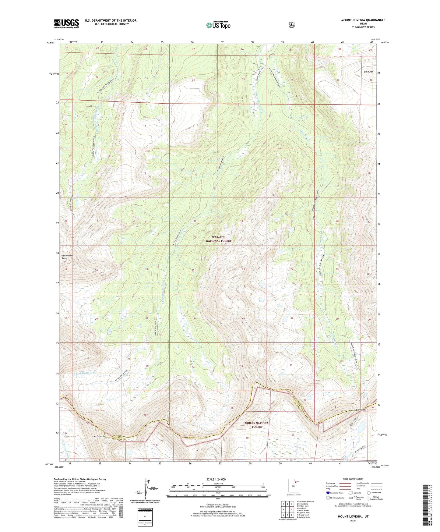
Mount Lovenia Utah US Topo Map
Couldn't load pickup availability
Also explore the Mount Lovenia Forest Service Topo of this same quad for updated USFS data
2023 topographic map quadrangle Mount Lovenia in the state of Utah. Scale: 1:24000. Based on the newly updated USGS 7.5' US Topo map series, this map is in the following counties: Summit, Duchesne. The map contains contour data, water features, and other items you are used to seeing on USGS maps, but also has updated roads and other features. This is the next generation of topographic maps. Printed on high-quality waterproof paper with UV fade-resistant inks.
Quads adjacent to this one:
West: Red Knob
Northwest: Elizabeth Mountain
North: Lyman Lake
Northeast: Bridger Lake
East: Mount Powell
Southeast: Garfield Basin
South: Oweep Creek
Southwest: Explorer Peak
This map covers the same area as the classic USGS quad with code o40110g5.
Contains the following named places: Bald Mountain, Little East Fork, Mount Lovenia, Squaw Pass, Tokewanna Peak