
MyTopo
Neola Utah US Topo Map
Couldn't load pickup availability
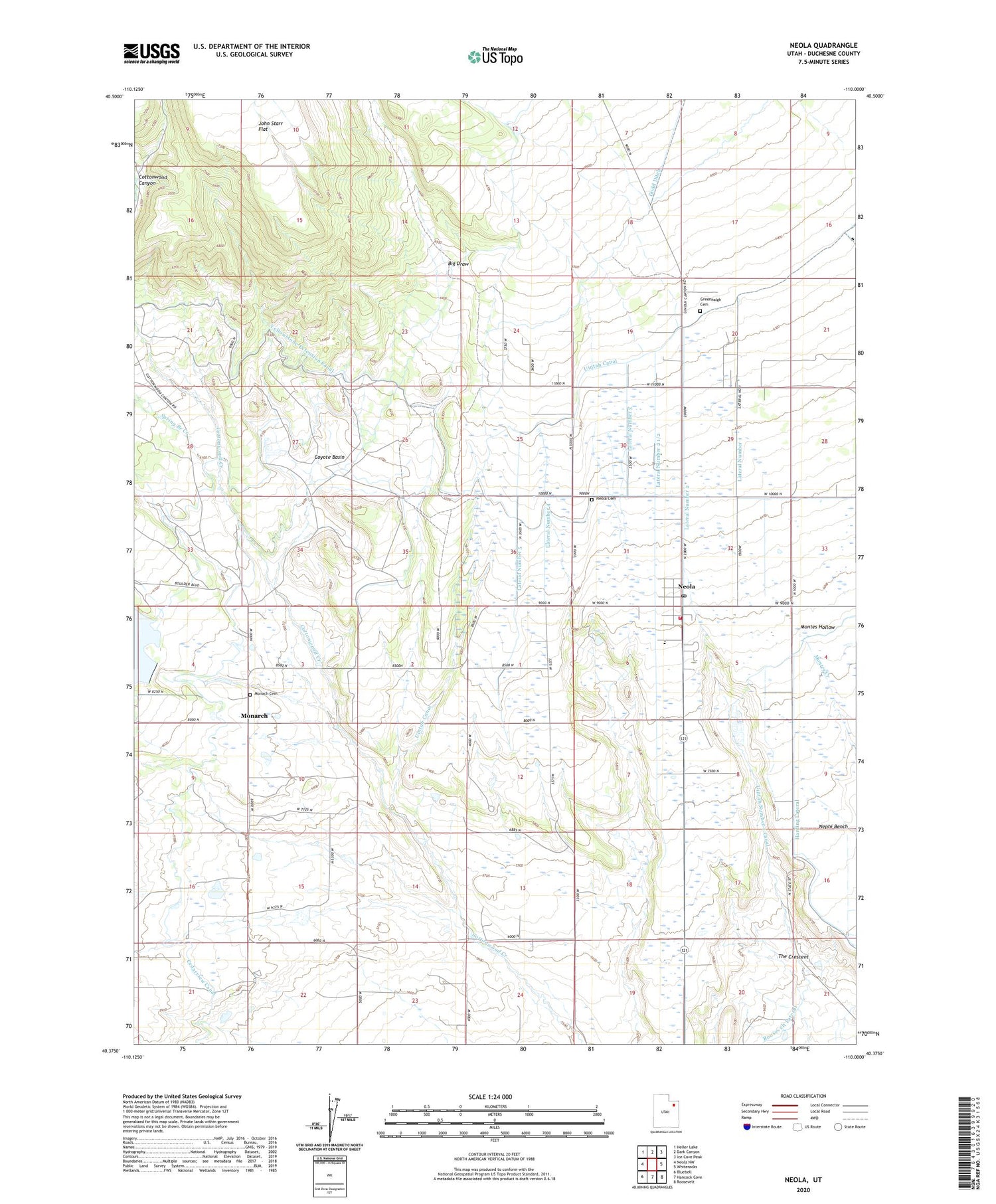
2020 topographic map quadrangle Neola in the state of Utah. Scale: 1:24000. Based on the newly updated USGS 7.5' US Topo map series, this map is in the following counties: Duchesne. The map contains contour data, water features, and other items you are used to seeing on USGS maps, but also has updated roads and other features. This is the next generation of topographic maps. Printed on high-quality waterproof paper with UV fade-resistant inks.
Quads adjacent to this one:
West: Neola NW
Northwest: Heller Lake
North: Dark Canyon
Northeast: Ice Cave Peak
East: Whiterocks
Southeast: Roosevelt
South: Hancock Cove
Southwest: Bluebell
Contains the following named places: Big Draw, Browns Draw Dam, Cedarview Canal, Coyote Basin, Dodd Ditch, Greenhalgh Cemetery, Lateral Number 1, Lateral Number 2, Lateral Number 2 1/2, Lateral Number 3, Lateral Number 4, Lateral Number 5, Monach Cemetery, Monarch, Neola, Neola Cemetery, Neola Census Designated Place, Neola Elementary School, Neola Fire Department, Neola Post Office, Spring Branch Creek, The Church of Jesus Christ of Latter Day Saints, Uintah Canal, ZIP Code: 84053


