MyTopo
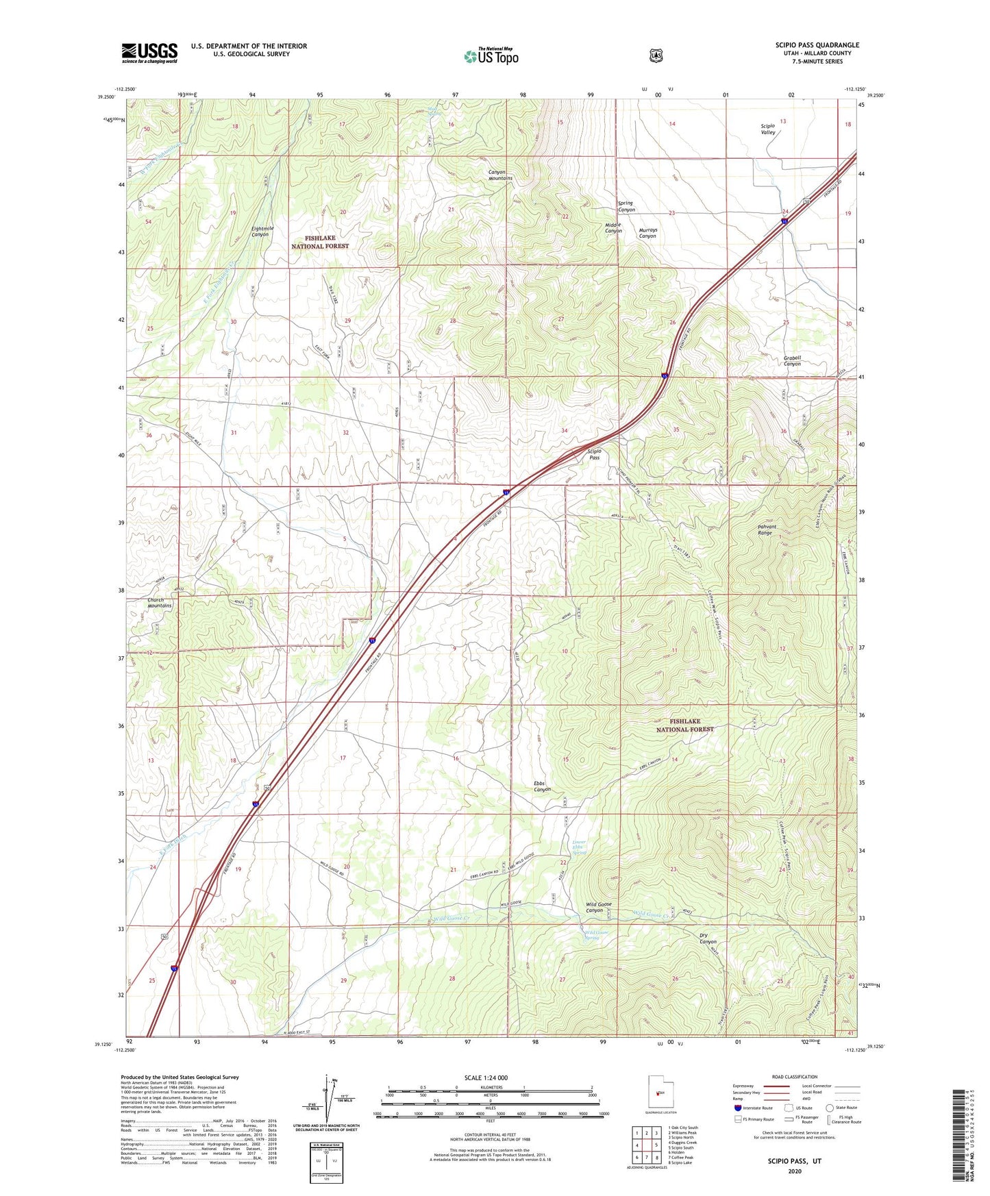
Scipio Pass Utah US Topo Map
Couldn't load pickup availability
Also explore the Scipio Pass Forest Service Topo of this same quad for updated USFS data
2023 topographic map quadrangle Scipio Pass in the state of Utah. Scale: 1:24000. Based on the newly updated USGS 7.5' US Topo map series, this map is in the following counties: Millard. The map contains contour data, water features, and other items you are used to seeing on USGS maps, but also has updated roads and other features. This is the next generation of topographic maps. Printed on high-quality waterproof paper with UV fade-resistant inks.
Quads adjacent to this one:
West: Duggins Creek
Northwest: Oak City South
North: Williams Peak
Northeast: Scipio North
East: Scipio South
Southeast: Scipio Lake
South: Coffee Peak
Southwest: Holden
This map covers the same area as the classic USGS quad with code o39112b2.
Contains the following named places: Dry Canyon, East Fork Ditch, Ebbs Canyon, Graball Canyon, Holden Wildlife Management Area, Lower Ebbs Spring, Middle Canyon, Mud Spring, Murrays Canyon, Scipio Pass, Spring Canyon, Wild Goose Canyon, Wild Goose Spring, Young Field Wildlife Management Area