MyTopo
Ophir Utah US Topo Map
Couldn't load pickup availability
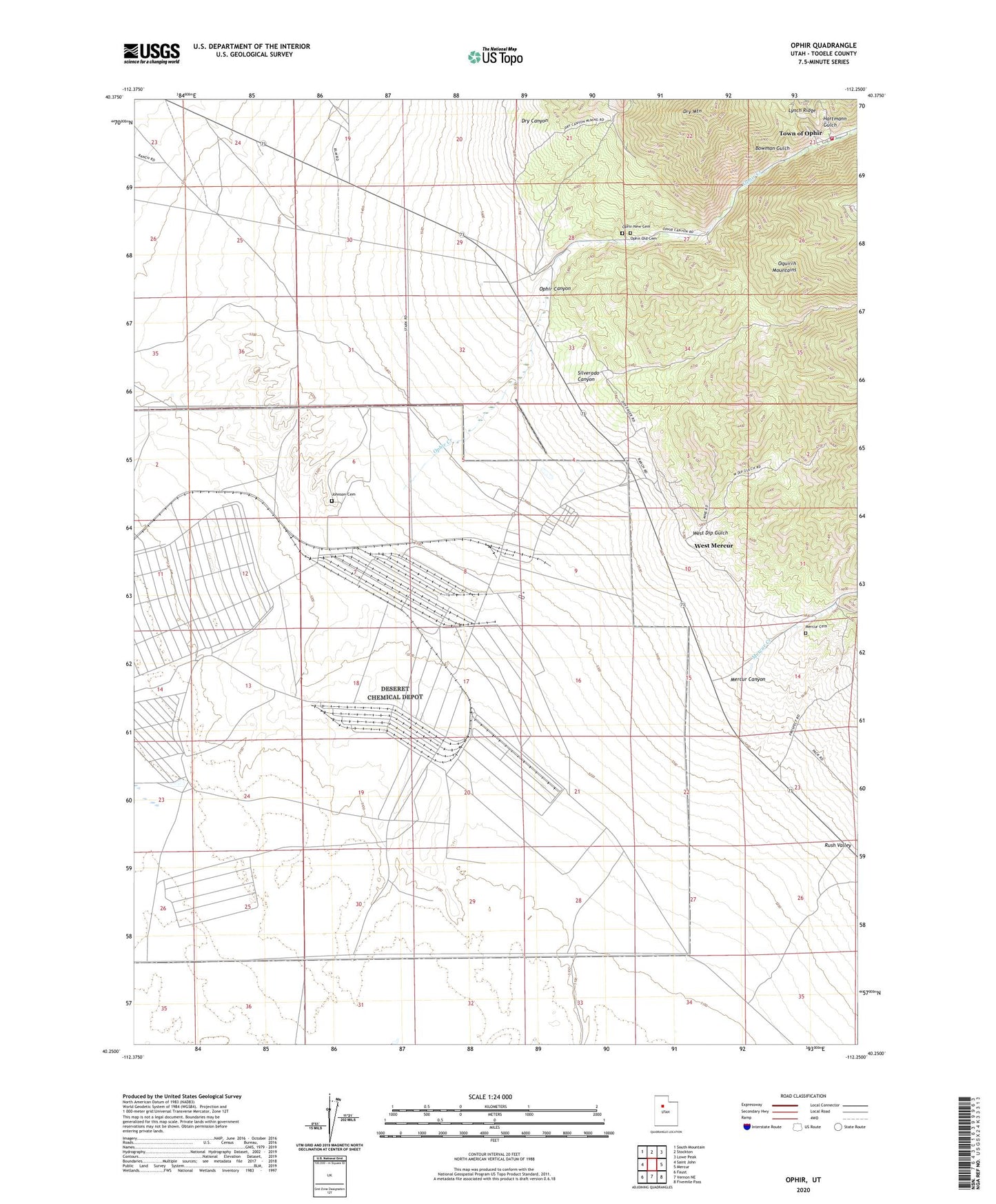
2020 topographic map quadrangle Ophir in the state of Utah. Scale: 1:24000. Based on the newly updated USGS 7.5' US Topo map series, this map is in the following counties: Tooele. The map contains contour data, water features, and other items you are used to seeing on USGS maps, but also has updated roads and other features. This is the next generation of topographic maps. Printed on high-quality waterproof paper with UV fade-resistant inks.
Quads adjacent to this one:
West: Saint John
Northwest: South Mountain
North: Stockton
Northeast: Lowe Peak
East: Mercur
Southeast: Fivemile Pass
South: Vernon NE
Southwest: Faust
Contains the following named places: Bates Ranch, Bowman Gulch, Deseret Chemical Depot, Dry Canyon, Dry Mountain, Gillmore Well, Hartmann Gulch, Johnson Cemetery, Mercur Canyon, Mercur Cemetery, Mercur Creek, Montana Mine, Ophir, Ophir Canyon, Ophir Creek, Ophir Fire Department, Ophir New Cemetery, Ophir Old Cemetery, Silverado Canyon, Town of Ophir, West Dip Gulch, West Mercur