MyTopo
Peterson Utah US Topo Map
Couldn't load pickup availability
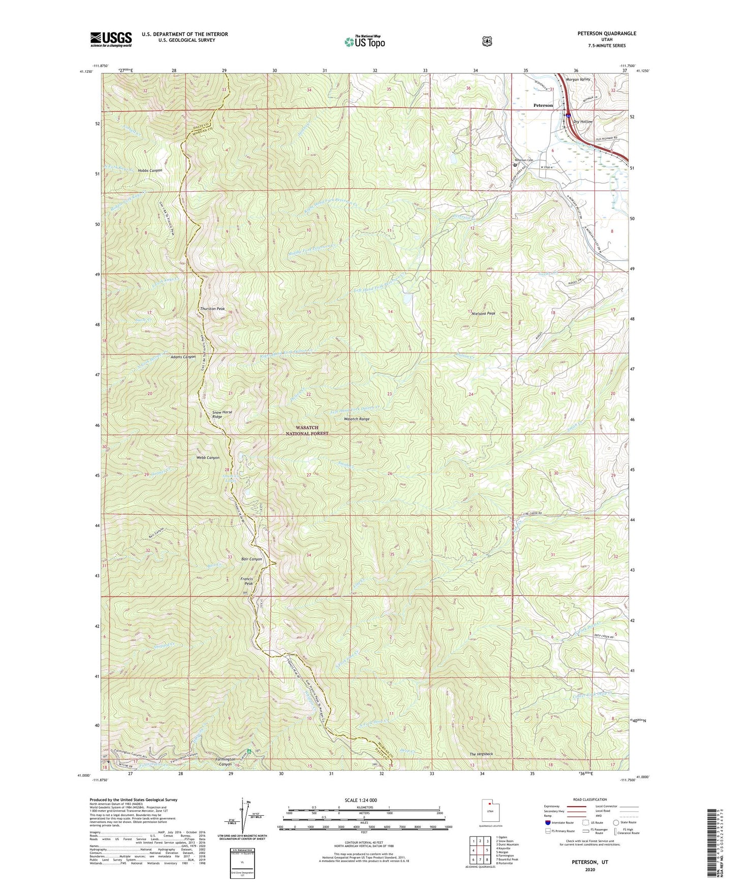
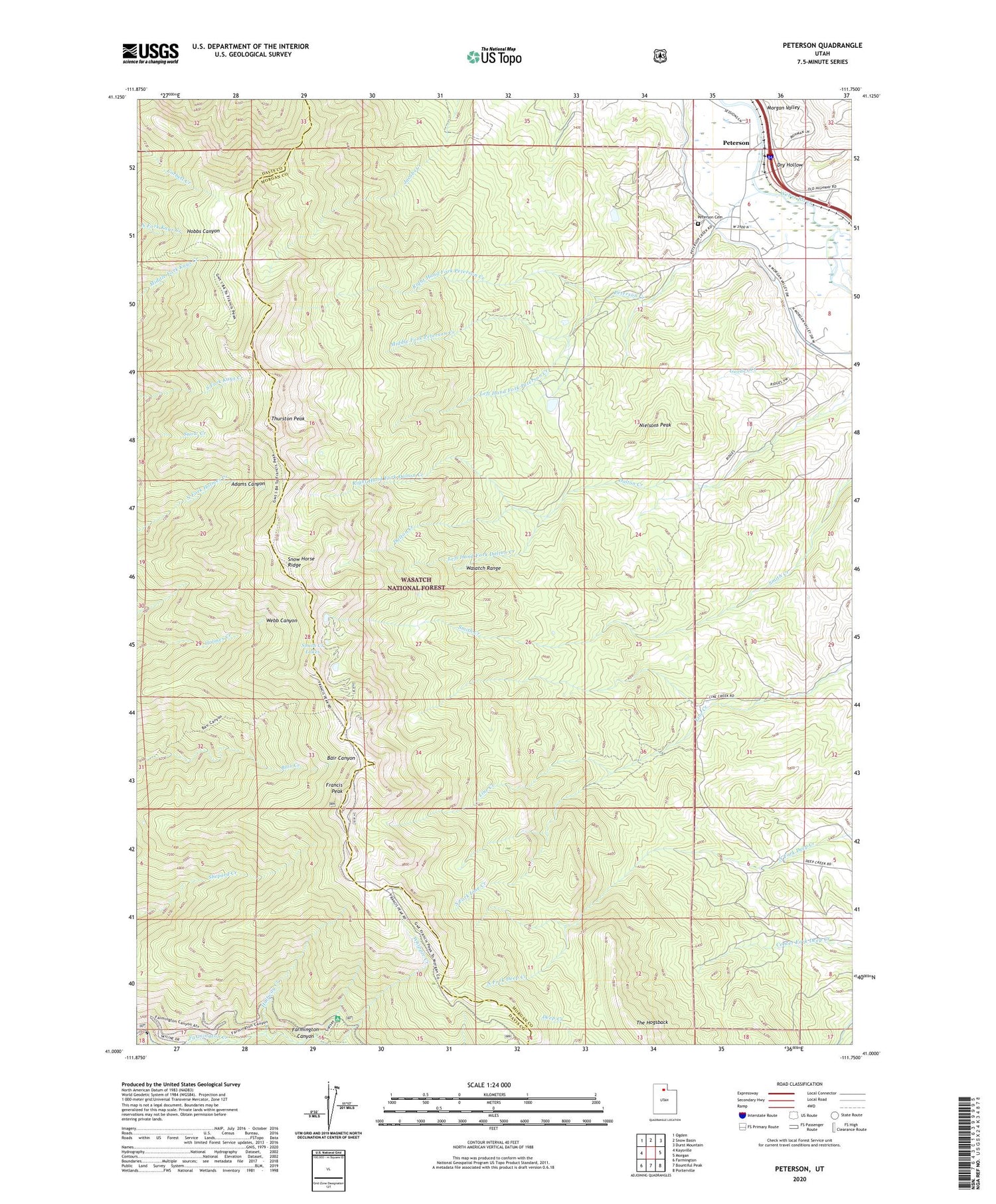
2020 topographic map quadrangle Peterson in the state of Utah. Scale: 1:24000. Based on the newly updated USGS 7.5' US Topo map series, this map is in the following counties: Morgan, Davis. The map contains contour data, water features, and other items you are used to seeing on USGS maps, but also has updated roads and other features. This is the next generation of topographic maps. Printed on high-quality waterproof paper with UV fade-resistant inks.
Quads adjacent to this one:
West: Kaysville
Northwest: Ogden
North: Snow Basin
Northeast: Durst Mountain
East: Morgan
Southeast: Porterville
South: Bountiful Peak
Southwest: Farmington
Contains the following named places: Corduroy Creek, Dry Hollow, Enterprise Slough, Francis Peak, Francis Peak Heliport, Francis Peak Overlook, Francis Peak Pumping Station, Francis Radar Station, Gateway Canal, Gorder Creek, Halfway Creek, Left Hand Fork Dalton Creek, Left Hand Fork Peterson Creek, Middle Fork Peterson Creek, Morris Creek, Nielsons Peak, Peterson, Peterson Cemetery, Peterson Creek, Right Hand Fork Dalton Creek, Right Hand Fork Peterson Creek, Shepard Peak Recreation Site, Smith Creek Lakes, Snow Horse Ridge, South Fork Line Creek, Sunset Campground, The Church of Jesus Christ of Latter Day Saints, The Hogsback, Thurston Peak