MyTopo
Pinto Utah US Topo Map
Couldn't load pickup availability
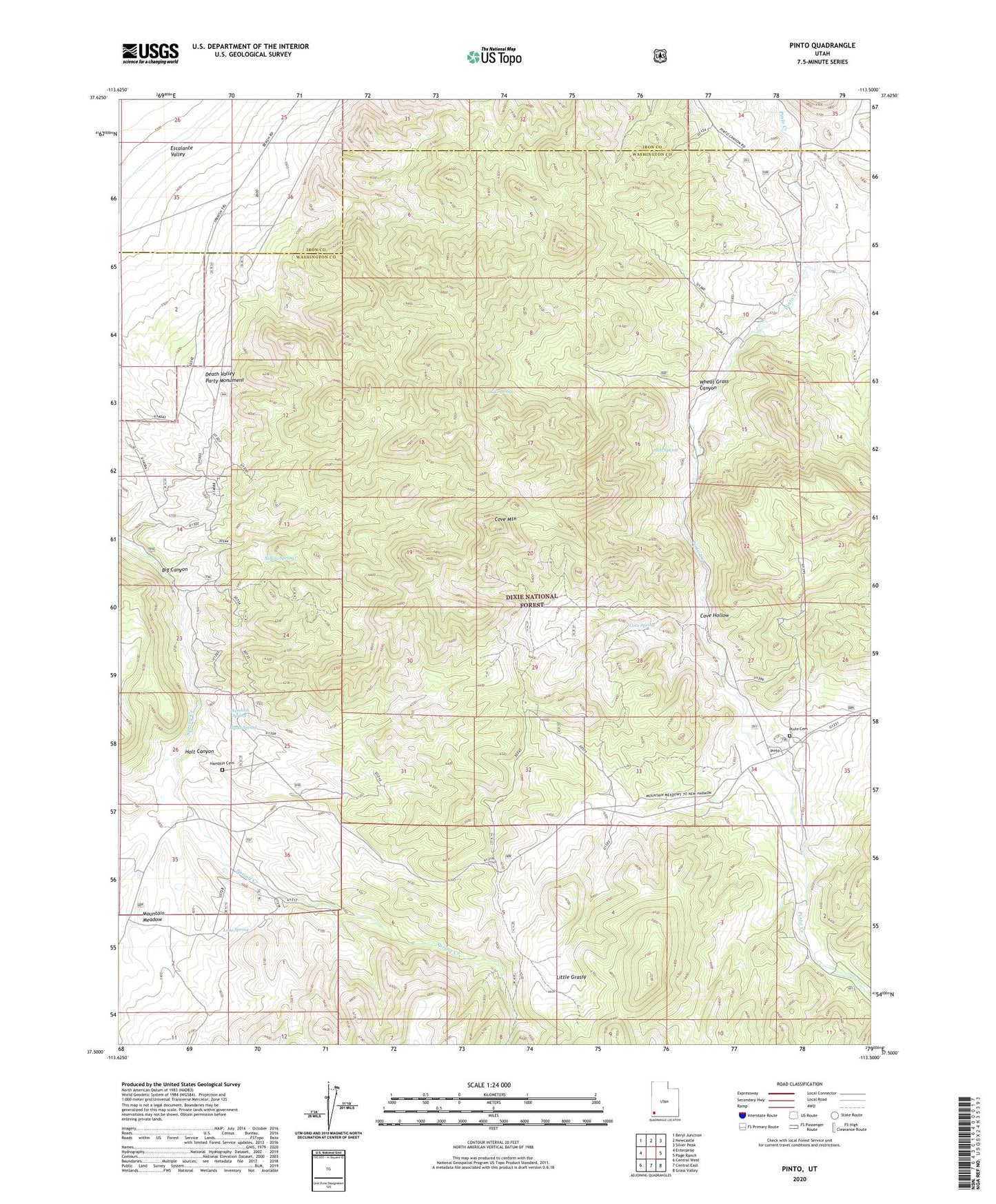
2020 topographic map quadrangle Pinto in the state of Utah. Scale: 1:24000. Based on the newly updated USGS 7.5' US Topo map series, this map is in the following counties: Washington, Iron. The map contains contour data, water features, and other items you are used to seeing on USGS maps, but also has updated roads and other features. This is the next generation of topographic maps. Printed on high-quality waterproof paper with UV fade-resistant inks.
Quads adjacent to this one:
West: Enterprise
Northwest: Beryl Junction
North: Newcastle
Northeast: Silver Peak
East: Page Ranch
Southeast: Grass Valley
South: Central East
Southwest: Central West
Contains the following named places: Big Canyon, Cove Hollow, Cove Mountain, Cove Spring, Death Valley Party Monument, Hamblin Cemetery, Hamblin Historical Site, Hamblin Spring, Hyatt Spring, Jefferson Hunt Monument, Little Grassy, Lone Spring, Meadow Valley Creek, Mountain Meadow, Oak Spring, Pinto, Pinto Cemetery, Platt Spring, Spring Creek, Wheat Grass Canyon, Yellow Spring, ZIP Code: 84756