MyTopo
Roosevelt Utah US Topo Map
Couldn't load pickup availability
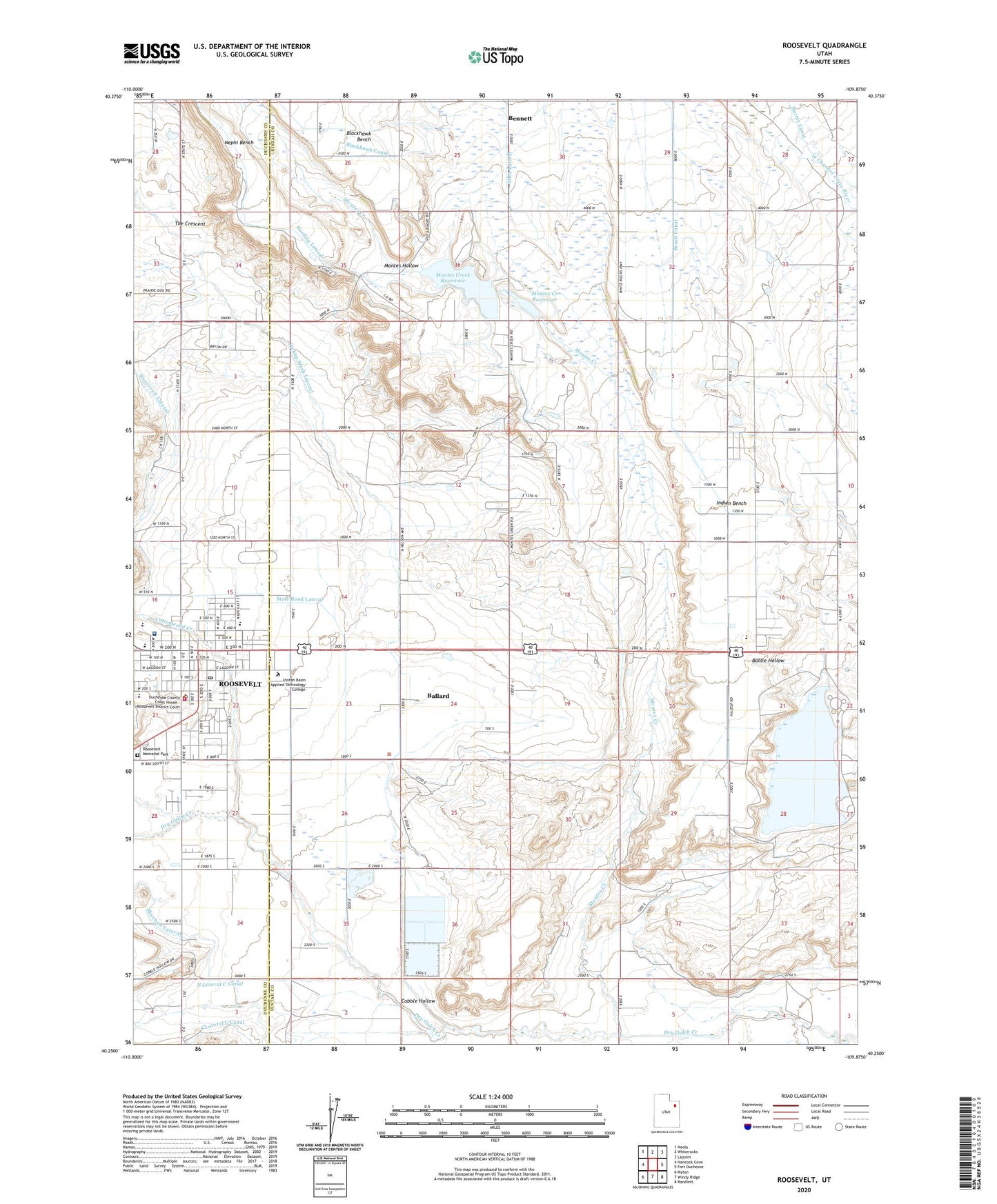
2020 topographic map quadrangle Roosevelt in the state of Utah. Scale: 1:24000. Based on the newly updated USGS 7.5' US Topo map series, this map is in the following counties: Uintah, Duchesne. The map contains contour data, water features, and other items you are used to seeing on USGS maps, but also has updated roads and other features. This is the next generation of topographic maps. Printed on high-quality waterproof paper with UV fade-resistant inks.
Quads adjacent to this one:
West: Hancock Cove
Northwest: Neola
North: Whiterocks
Northeast: Lapoint
East: Fort Duchesne
Southeast: Randlett
South: Windy Ridge
Southwest: Myton
Contains the following named places: Ballard, Bench Canal, Bennett, Blackhawk Lateral, Bottle Hollow Reservoir, Cobble Hollow, Cottonwood Creek, Eagle View Elementary School, East Elementary School, Faith Lutheran Church, Fort Duchesne Census Designated Place, Harding Lateral, Indian Bench, Jehovahs Witnesses Roosevelt Congregation, KNEU-AM (Roosevelt), Lynn Haslem Dam, Lynn Haslem Reservoir, Montes Creek, Montes Creek Dam, Montes Creek Reservoir, Montes Hollow, Mountainwest Mobile Home Campground, Pickup Wash Lateral, Roosevelt, Roosevelt Christian Assembly, Roosevelt Fire Department, Roosevelt Junior High School, Roosevelt Memorial Park, Roosevelt Police Department, Roosevelt Post Office, Saint Helens Catholic Church, State Road Lateral, The Church of Jesus Christ of Latter Day Saints, Town of Ballard, Uintah Basin Medical Center, Union High School, Utah Highway Patrol Section 5 Roosevelt Office, Ute Mission, West Junior High School