MyTopo
Sabie Mountain Utah US Topo Map
Couldn't load pickup availability
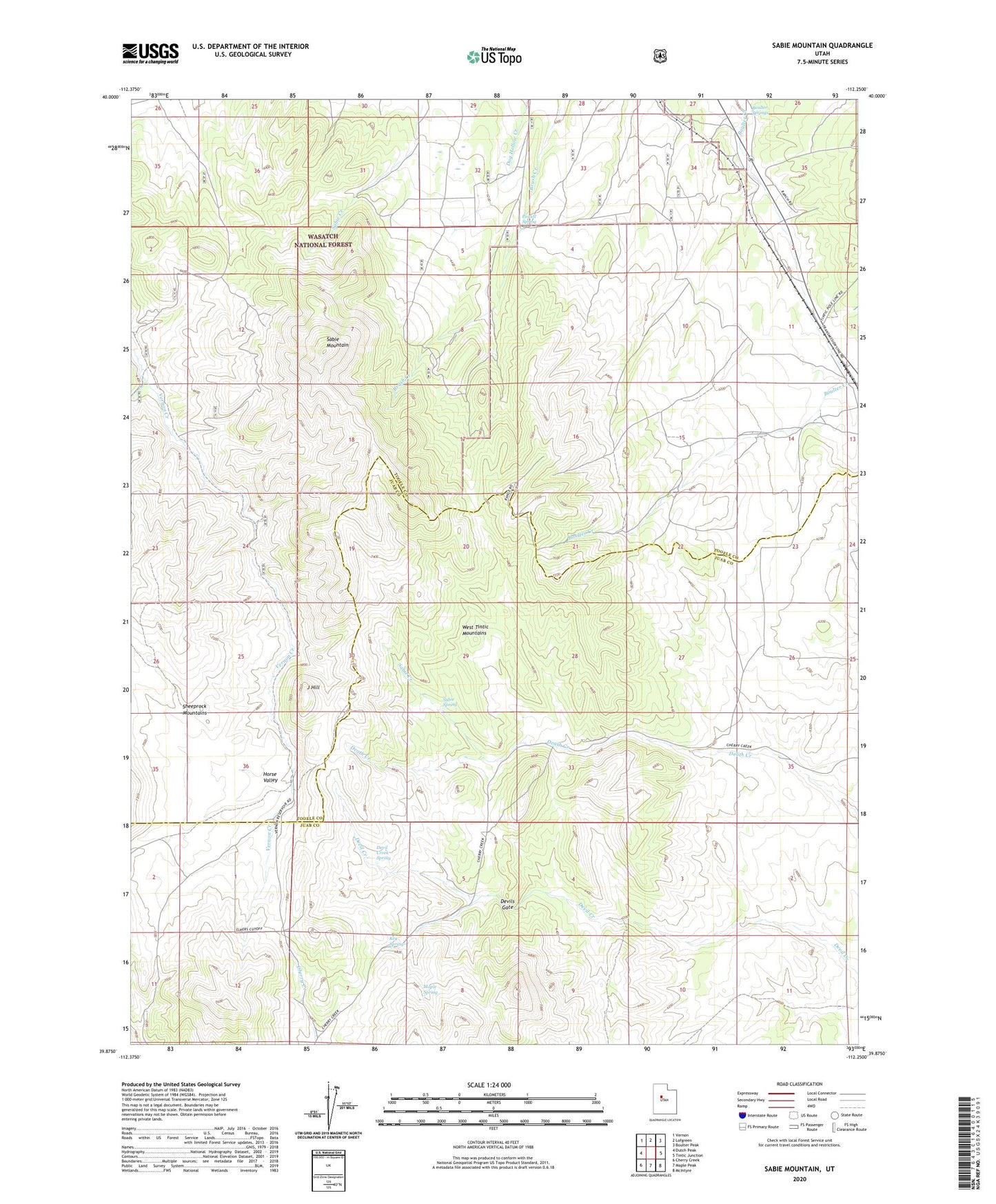
2020 topographic map quadrangle Sabie Mountain in the state of Utah. Scale: 1:24000. Based on the newly updated USGS 7.5' US Topo map series, this map is in the following counties: Tooele, Juab. The map contains contour data, water features, and other items you are used to seeing on USGS maps, but also has updated roads and other features. This is the next generation of topographic maps. Printed on high-quality waterproof paper with UV fade-resistant inks.
Quads adjacent to this one:
West: Dutch Peak
Northwest: Vernon
North: Lofgreen
Northeast: Boulter Peak
East: Tintic Junction
Southeast: McIntyre
South: Maple Peak
Southwest: Cherry Creek
Contains the following named places: Boulter Springs, Devil Creek Spring, Devils Gate, Dry Farm, Horse Valley, J Hill, Keg Spring, Little Valley Creek, Maple Spring, Powell Spring, Sabie Creek, Sabie Mountain, Sabie Spring, Summer Ranch