MyTopo
Tintic Junction Utah US Topo Map
Couldn't load pickup availability
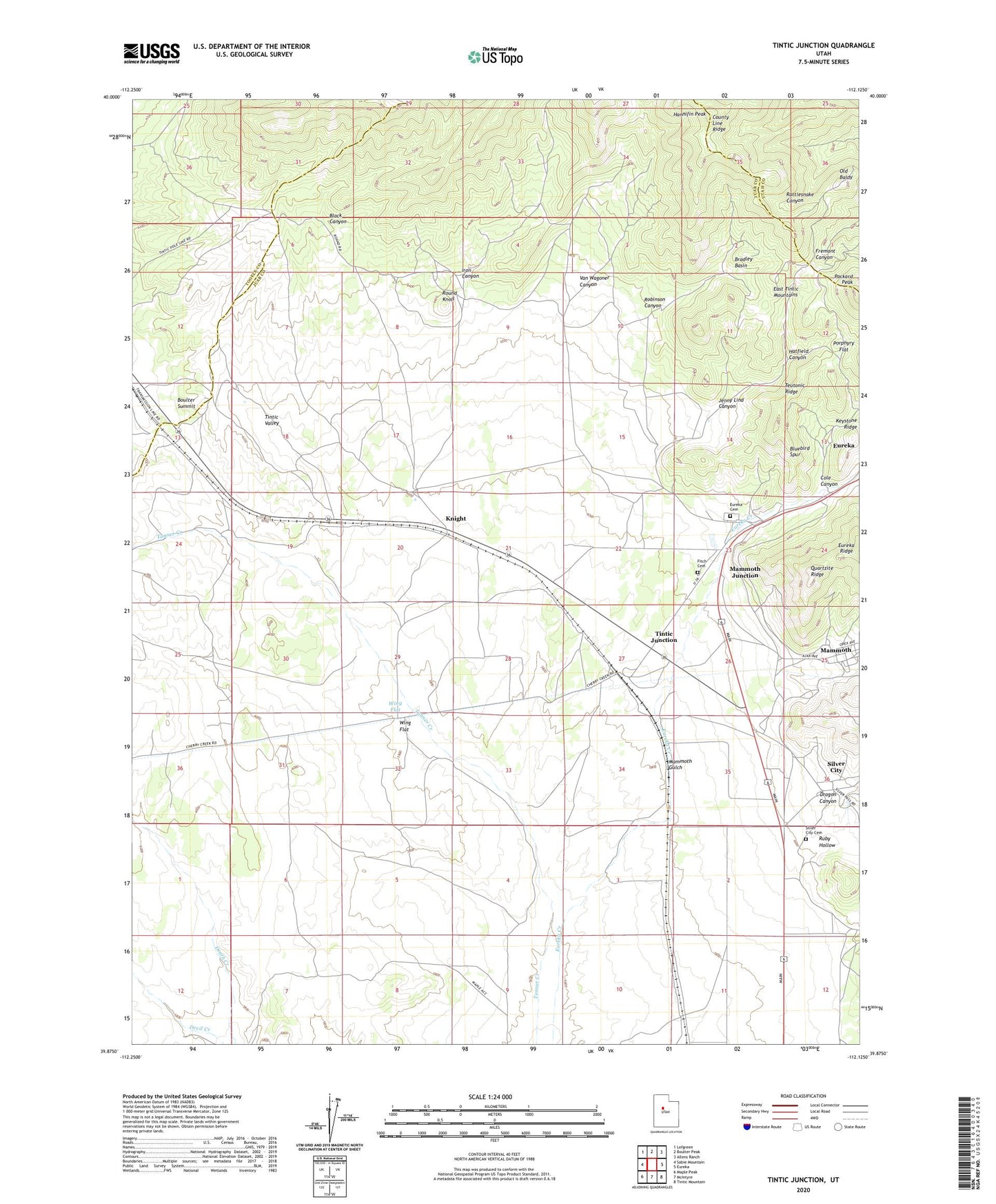
2023 topographic map quadrangle Tintic Junction in the state of Utah. Scale: 1:24000. Based on the newly updated USGS 7.5' US Topo map series, this map is in the following counties: Juab, Tooele, Utah. The map contains contour data, water features, and other items you are used to seeing on USGS maps, but also has updated roads and other features. This is the next generation of topographic maps. Printed on high-quality waterproof paper with UV fade-resistant inks.
Quads adjacent to this one:
West: Sabie Mountain
Northwest: Lofgreen
North: Boulter Peak
Northeast: Allens Ranch
East: Eureka
Southeast: Tintic Mountain
South: McIntyre
Southwest: Maple Peak
This map covers the same area as the classic USGS quad with code o39112h2.
Contains the following named places: Black Canyon, Black Warrior Mine, Bluebird Spur, Boulter, Boulter Summit, Bradley Basin, Bradley Mine, Cole Canyon, County Line Ridge, Dagmar Mine, Dan Hough Mine, Dragon Canyon, Eureka Cemetery, Evans Mine, Fields Prospect, Fitch Cemetery, Four Aces Mine, Garity Quarry, General Logan Mine, Golden Ray Mine, Golden Sunset Mine, Hannifin Peak, Hannifin Ranch, Hatfield Canyon, Herkimer, Iron Canyon, Jenny Lind Canyon, Keystone Ridge, Kingsley Mine, Knight, Limestone Quarry, Mammoth, Mammoth Gulch, Mammoth Junction, Munding Prospect, North Beck Mine, Old Baldy, Picnic Mine, Porphyry Flat, Quartzite Ridge, Retribution Mine, Robinson Canyon, Round Knoll, Ruby Hollow, Sacramento Mine, Silver Bow Mine, Silver City, Silver City Cemetery, Snell Ranch, Swansea Mine, Teutonic Ridge, Tintic Junction, Tintic Prince Mine, Tintic Station, Van Wagoner Canyon, Van Wagoner Mine, Victoria Northwest Mine, Waveland Mine, West Swansea Mine, Wing Flat, Yankee Girl Mine, ZIP Code: 84628