MyTopo
Boulter Peak Utah US Topo Map
Couldn't load pickup availability
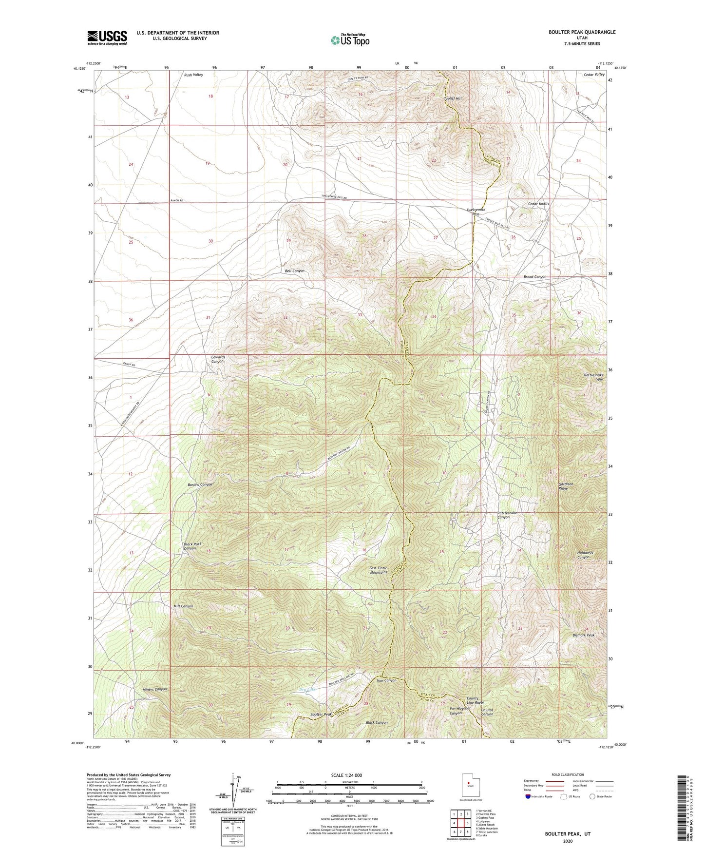
2023 topographic map quadrangle Boulter Peak in the state of Utah. Scale: 1:24000. Based on the newly updated USGS 7.5' US Topo map series, this map is in the following counties: Tooele, Utah, Juab. The map contains contour data, water features, and other items you are used to seeing on USGS maps, but also has updated roads and other features. This is the next generation of topographic maps. Printed on high-quality waterproof paper with UV fade-resistant inks.
Quads adjacent to this one:
West: Lofgreen
Northwest: Vernon NE
North: Fivemile Pass
Northeast: Goshen Pass
East: Allens Ranch
Southeast: Eureka
South: Tintic Junction
Southwest: Sabie Mountain
This map covers the same area as the classic USGS quad with code o40112a2.
Contains the following named places: Barlow Canyon, Bell Canyon, Bismark Peak, Black Rock Canyon, Boulter Peak, Broad Canyon, Cedar Knolls, Dry Lake, Edwards Canyon, Gardison Ridge, Hot Stuff Mine, Mill Canyon, Miners Canyon, New Bullion Mine, Rattlesnake Canyon, Rattlesnake Spur, Scranton Mine, Silver Dollar Mine, Twelvemile Pass