MyTopo
Sams Canyon Utah US Topo Map
Couldn't load pickup availability
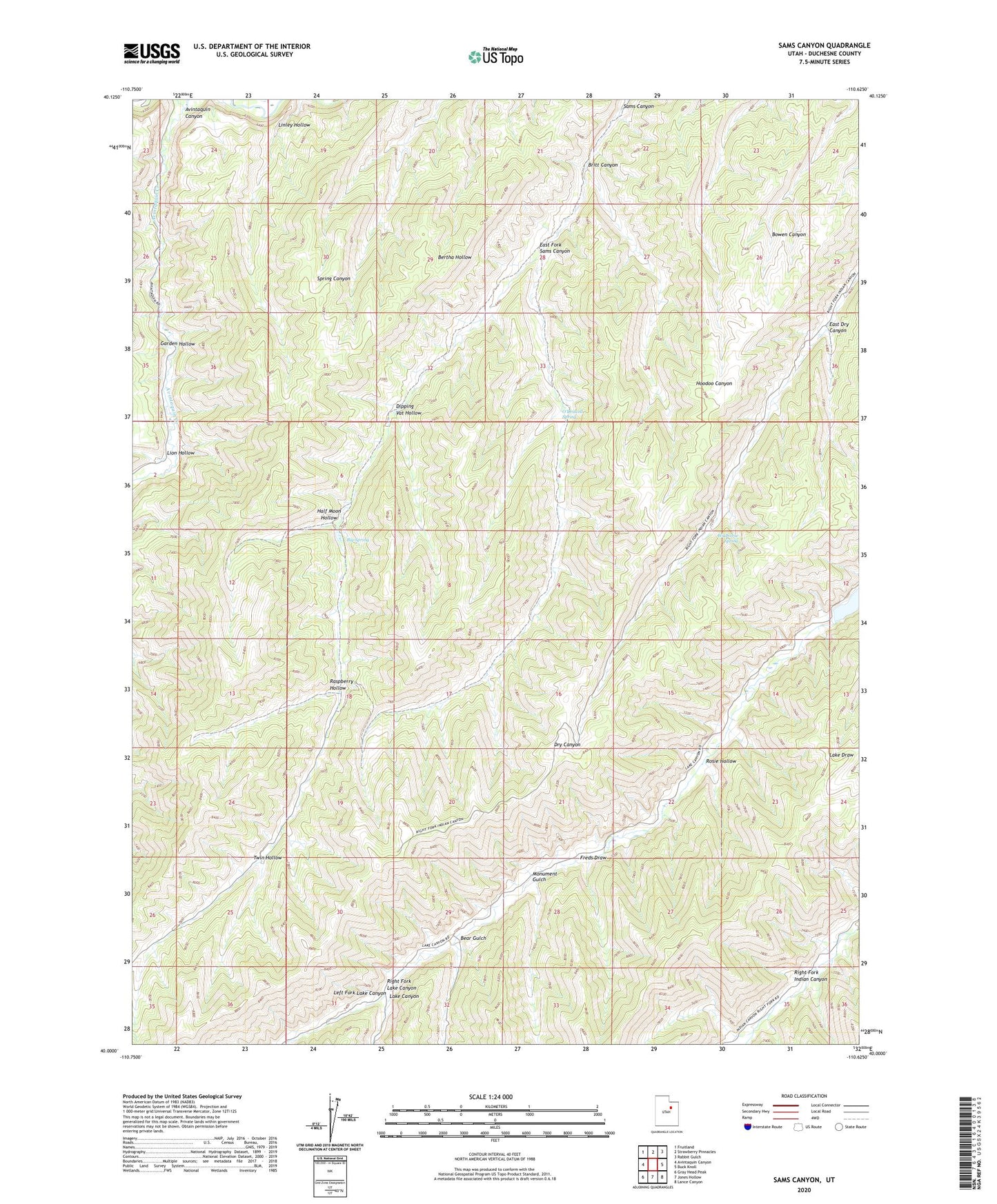
2020 topographic map quadrangle Sams Canyon in the state of Utah. Scale: 1:24000. Based on the newly updated USGS 7.5' US Topo map series, this map is in the following counties: Duchesne. The map contains contour data, water features, and other items you are used to seeing on USGS maps, but also has updated roads and other features. This is the next generation of topographic maps. Printed on high-quality waterproof paper with UV fade-resistant inks.
Quads adjacent to this one:
West: Avintaquin Canyon
Northwest: Fruitland
North: Strawberry Pinnacles
Northeast: Rabbit Gulch
East: Buck Knoll
Southeast: Lance Canyon
South: Jones Hollow
Southwest: Gray Head Peak
Contains the following named places: Avintaquin Canyon, Avintaquin Creek, Bear Gulch, Big Spring, Britt Canyon, Dipping Vat Hollow, East Dry Canyon, East Fork Sams Canyon, Frank Mine, Freds Draw, Garden Hollow, Half Moon Hollow, Lake Canyon Wildlife Management Area, Left Fork Lake Canyon, Linley Hollow, Lion Hollow, Monument Gulch, O'Driscoll Spring, Payne Mine, Raspberry Hollow, Right Fork Lake Canyon, Rosie Hollow, Twin Hollow, Wildhorse Spring