MyTopo
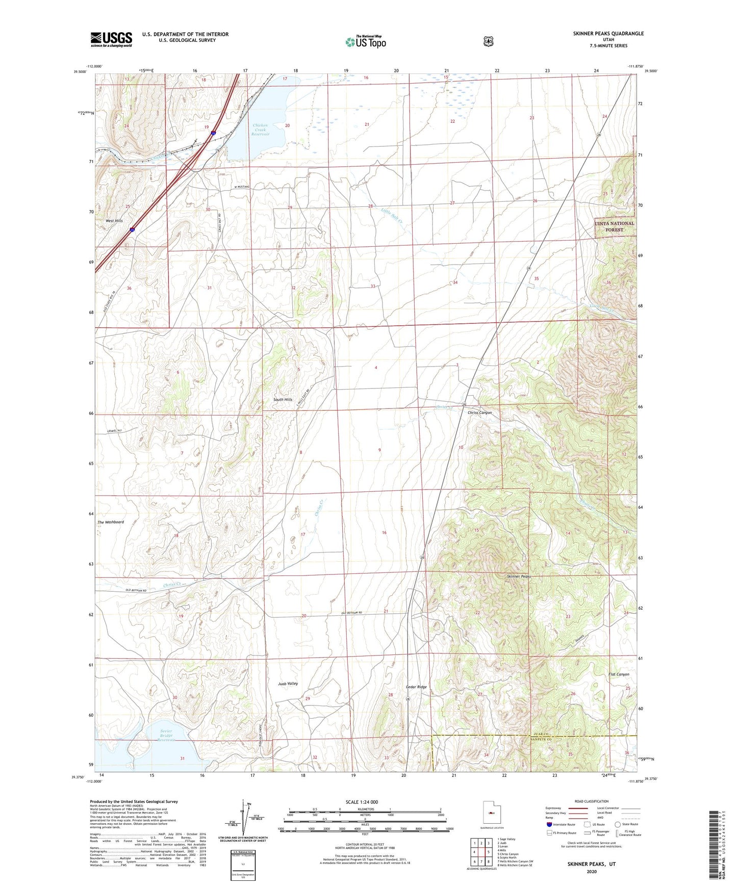
Skinner Peaks Utah US Topo Map
Couldn't load pickup availability
Also explore the Skinner Peaks Forest Service Topo of this same quad for updated USFS data
2023 topographic map quadrangle Skinner Peaks in the state of Utah. Scale: 1:24000. Based on the newly updated USGS 7.5' US Topo map series, this map is in the following counties: Juab, Sanpete. The map contains contour data, water features, and other items you are used to seeing on USGS maps, but also has updated roads and other features. This is the next generation of topographic maps. Printed on high-quality waterproof paper with UV fade-resistant inks.
Quads adjacent to this one:
West: Mills
Northwest: Sage Valley
North: Juab
Northeast: Levan
East: Chriss Canyon
Southeast: Hells Kitchen Canyon SE
South: Hells Kitchen Canyon SW
Southwest: Scipio North
This map covers the same area as the classic USGS quad with code o39111d8.
Contains the following named places: Cedar Ridge, Chicken Creek Dam, Chicken Creek Reservoir, Chriss Canyon, Juab Valley, Little Salt Creek, Skinner Peaks, South Hills, The Washboard