MyTopo
Scipio North Utah US Topo Map
Couldn't load pickup availability
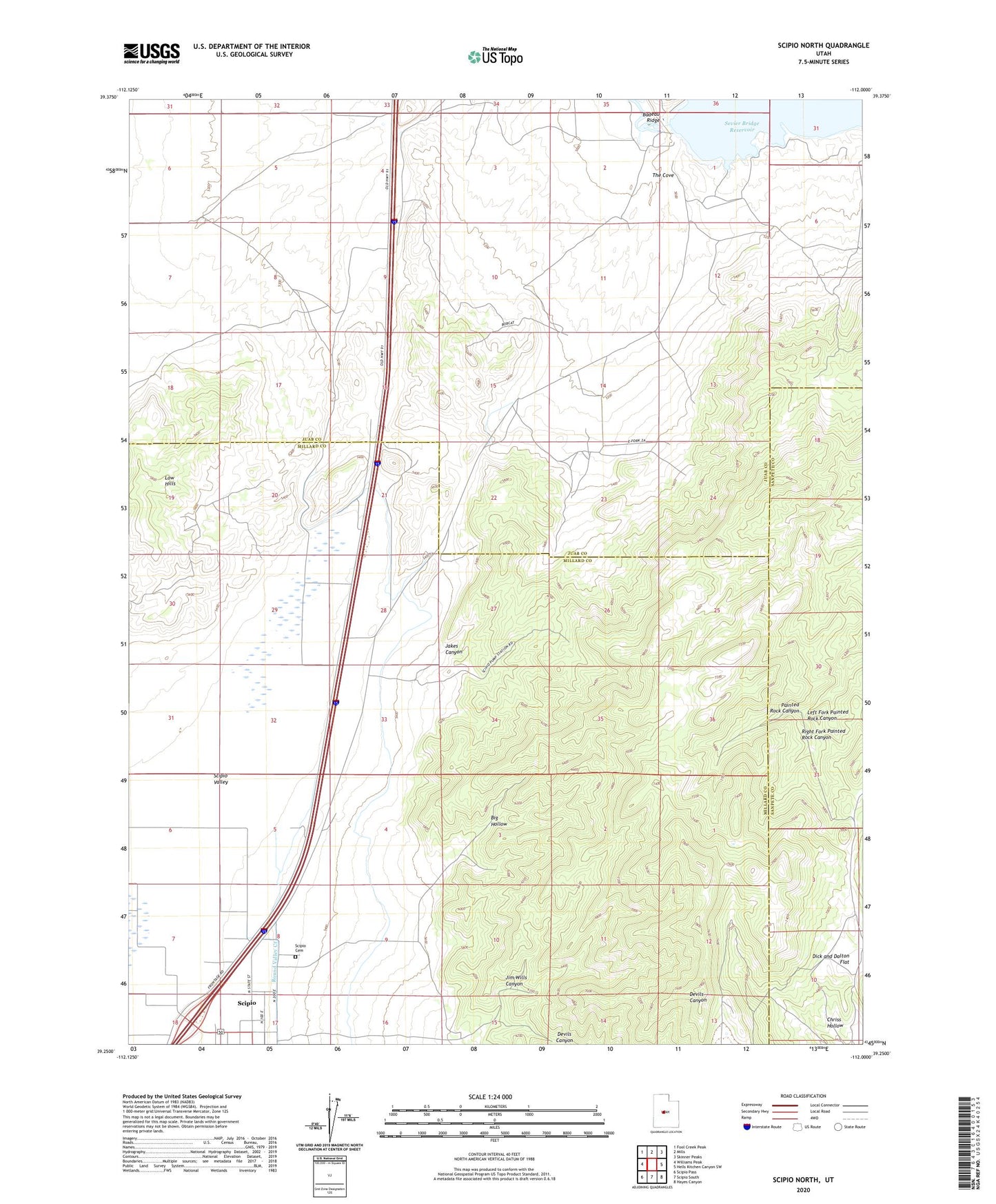
2023 topographic map quadrangle Scipio North in the state of Utah. Scale: 1:24000. Based on the newly updated USGS 7.5' US Topo map series, this map is in the following counties: Juab, Millard, Sanpete. The map contains contour data, water features, and other items you are used to seeing on USGS maps, but also has updated roads and other features. This is the next generation of topographic maps. Printed on high-quality waterproof paper with UV fade-resistant inks.
Quads adjacent to this one:
West: Williams Peak
Northwest: Fool Creek Peak
North: Mills
Northeast: Skinner Peaks
East: Hells Kitchen Canyon SW
Southeast: Hayes Canyon
South: Scipio South
Southwest: Scipio Pass
This map covers the same area as the classic USGS quad with code o39112c1.
Contains the following named places: Big Hollow, Chriss Hollow, Devils Canyon, Dick and Dalton Flat, Jakes Canyon, Jim Wills Canyon, Left Fork Painted Rock Canyon, Low Hills, Right Fork Painted Rock Canyon, Scipio Cemetery, Scipio Valley, Sevier Bridge Dam, The Cove, Yuba Dam