MyTopo
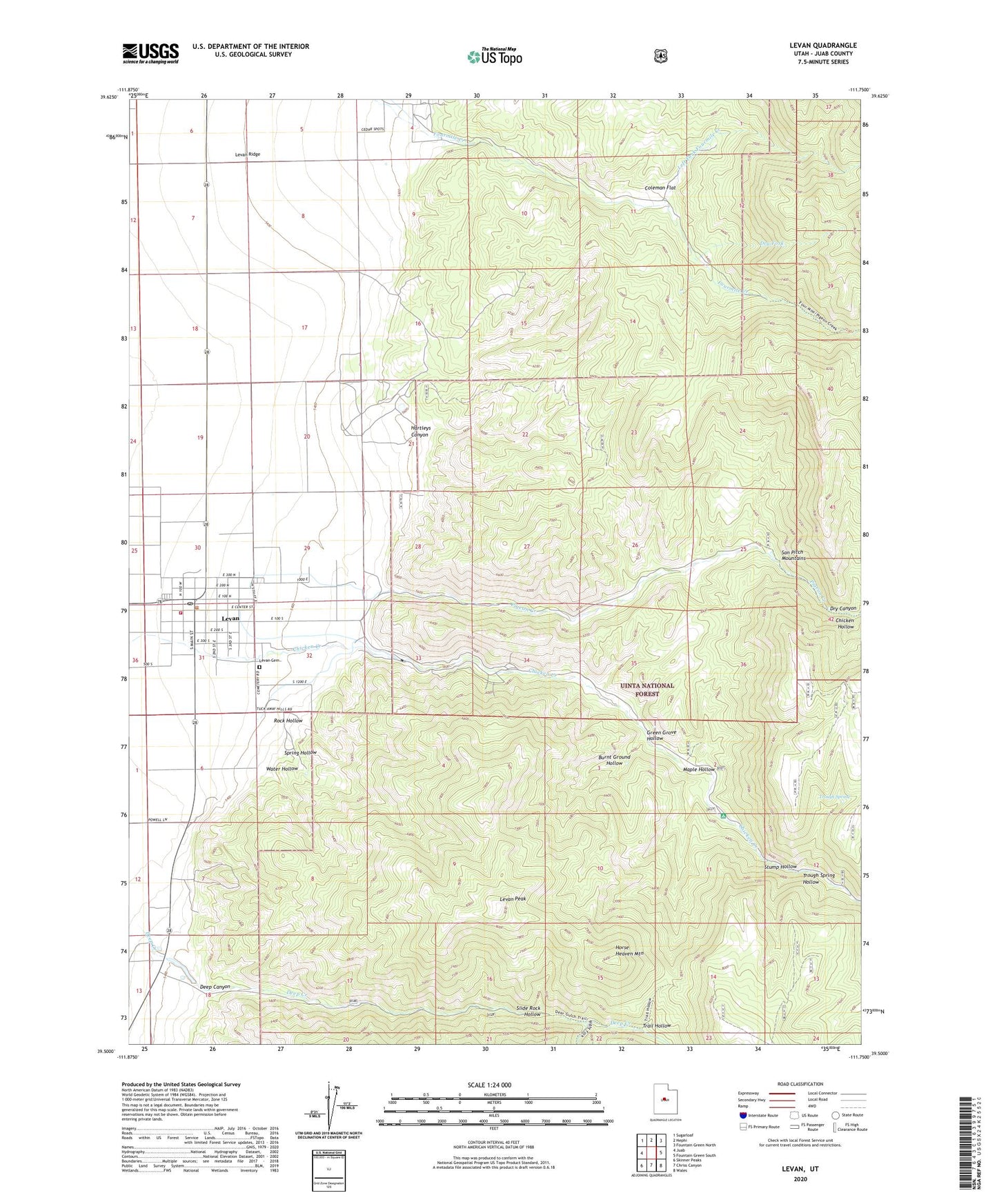
Levan Utah US Topo Map
Couldn't load pickup availability
Also explore the Levan Forest Service Topo of this same quad for updated USFS data
2023 topographic map quadrangle Levan in the state of Utah. Scale: 1:24000. Based on the newly updated USGS 7.5' US Topo map series, this map is in the following counties: Juab. The map contains contour data, water features, and other items you are used to seeing on USGS maps, but also has updated roads and other features. This is the next generation of topographic maps. Printed on high-quality waterproof paper with UV fade-resistant inks.
Quads adjacent to this one:
West: Juab
Northwest: Sugarloaf
North: Nephi
Northeast: Fountain Green North
East: Fountain Green South
Southeast: Wales
South: Chriss Canyon
Southwest: Skinner Peaks
This map covers the same area as the classic USGS quad with code o39111e7.
Contains the following named places: Burnt Ground Hollow, Chicken Creek Camp, Chicken Creek Campground, Chicken Hollow, Coleman Flat, Deep Canyon, Deep Creek, Deep Creek Wildlife Management Area, Dry Canyon, Dry Fork, Green Grove Hollow, Hartleys Canyon, Horse Heaven Mountain, Juab Special Service Fire District Levan Station, Left Fork Fourmile Creek, Levan, Levan Cemetery, Levan Fire Department, Levan Peak, Levan Post Office, Levan Ridge, Levan Wildlife Management Area, Maple Hollow, Pigeon Creek, Right Fork Deep Creek, Rock Hollow, Slide Rock Hollow, Spring Hollow, Stump Hollow, The Church of Jesus Christ of Latter Day Saints, Town of Levan, Trail Hollow, Trough Spring, Trough Spring Hollow, Water Hollow