MyTopo
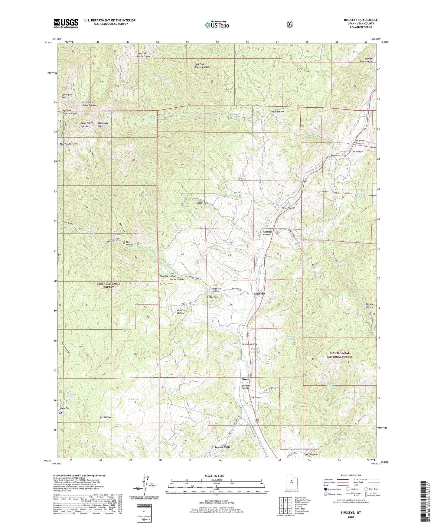
Birdseye Utah US Topo Map
Couldn't load pickup availability
Also explore the Birdseye Forest Service Topo of this same quad for updated USFS data
2023 topographic map quadrangle Birdseye in the state of Utah. Scale: 1:24000. Based on the newly updated USGS 7.5' US Topo map series, this map is in the following counties: Utah. The map contains contour data, water features, and other items you are used to seeing on USGS maps, but also has updated roads and other features. This is the next generation of topographic maps. Printed on high-quality waterproof paper with UV fade-resistant inks.
Quads adjacent to this one:
West: Payson Lakes
Northwest: Spanish Fork
North: Spanish Fork Peak
Northeast: Billies Mountain
East: Thistle
Southeast: Indianola
South: Spencer Canyon
Southwest: Nebo Basin
This map covers the same area as the classic USGS quad with code o39111h5.
Contains the following named places: Aggie Creek, Anderson Hollow, Asphaltum, Barney Hollow, Bennie Creek, Birdseye, Birdseye Quarry, Blackhawk Campground, Blind Canyon, Burdick Spring, Cat Canyon, Cedar Knoll, Cottonwood Spring, Cox Canyon, Cox Canyon Spring, Crab Creek, Deer Hollow, Gardner Hollow, Hudson Hollow, Hyle Hollow, Ives Canyon, Jackson Wildlife Management Area, Left Fork Crab Creek, Loafer Mountain, Loafer Ridge, Mahogany Ridge, Nebo Creek, Nielson Knoll, Oak Spring, Old Cart Hollow, Paces Hollow, Peery Mill Spring, Pines, Right Fork Crab Creek, Rock Hill Hollow, Santaquin Peak, The Church of Jesus Christ of Latter Day Saints, Thomas Hollow, Wildcat Canyon