MyTopo
Standardville Utah US Topo Map
Couldn't load pickup availability
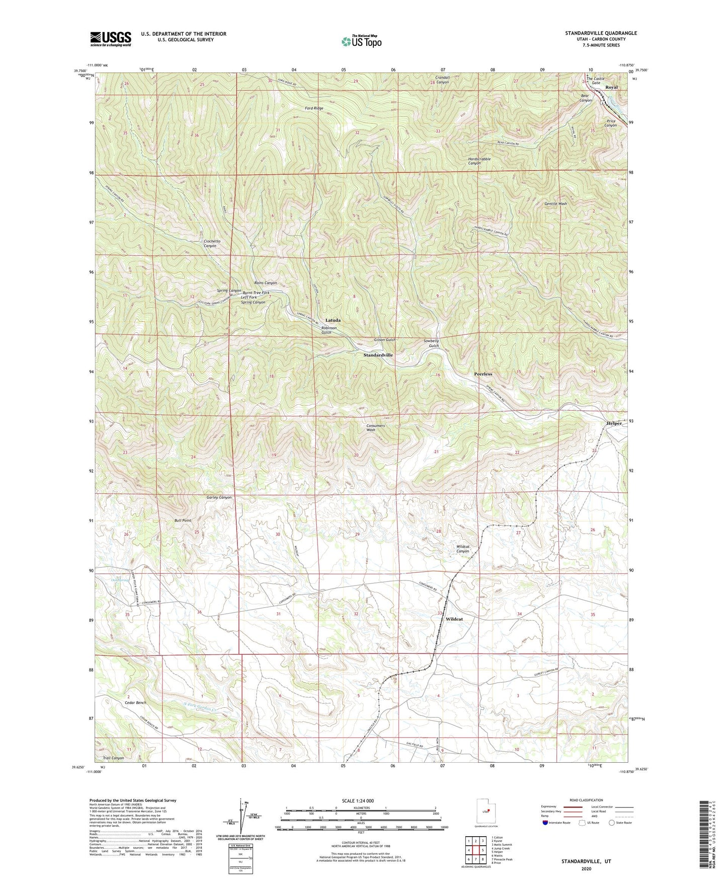
2023 topographic map quadrangle Standardville in the state of Utah. Scale: 1:24000. Based on the newly updated USGS 7.5' US Topo map series, this map is in the following counties: Carbon. The map contains contour data, water features, and other items you are used to seeing on USGS maps, but also has updated roads and other features. This is the next generation of topographic maps. Printed on high-quality waterproof paper with UV fade-resistant inks.
Quads adjacent to this one:
West: Jump Creek
Northwest: Colton
North: Kyune
Northeast: Matts Summit
East: Helper
Southeast: Price
South: Pinnacle Peak
Southwest: Wattis
This map covers the same area as the classic USGS quad with code o39110f8.
Contains the following named places: Bear Canyon, Bull Point, Burnt Tree Fork, Carbon Fuel Mine Number 2, Carbon Fuel Mine Number 3, Cedar Bench, Ciochetto Canyon, Gilson Gulch, Helper Division, Latuda, Left Fork Spring Canyon, Lone Pine Mine, Mutual, Oak Spring, Peerless, Peerless Mine, Rains, Rains Canyon, Robinson Gulch, Rolapp Mine, Royal, Sowbelly Gulch, Standardville, Storrs, The Castle Gate, Twin Washes, Wildcat, Wildcat Canyon, Wildcat Siding, ZIP Code: 84526