MyTopo
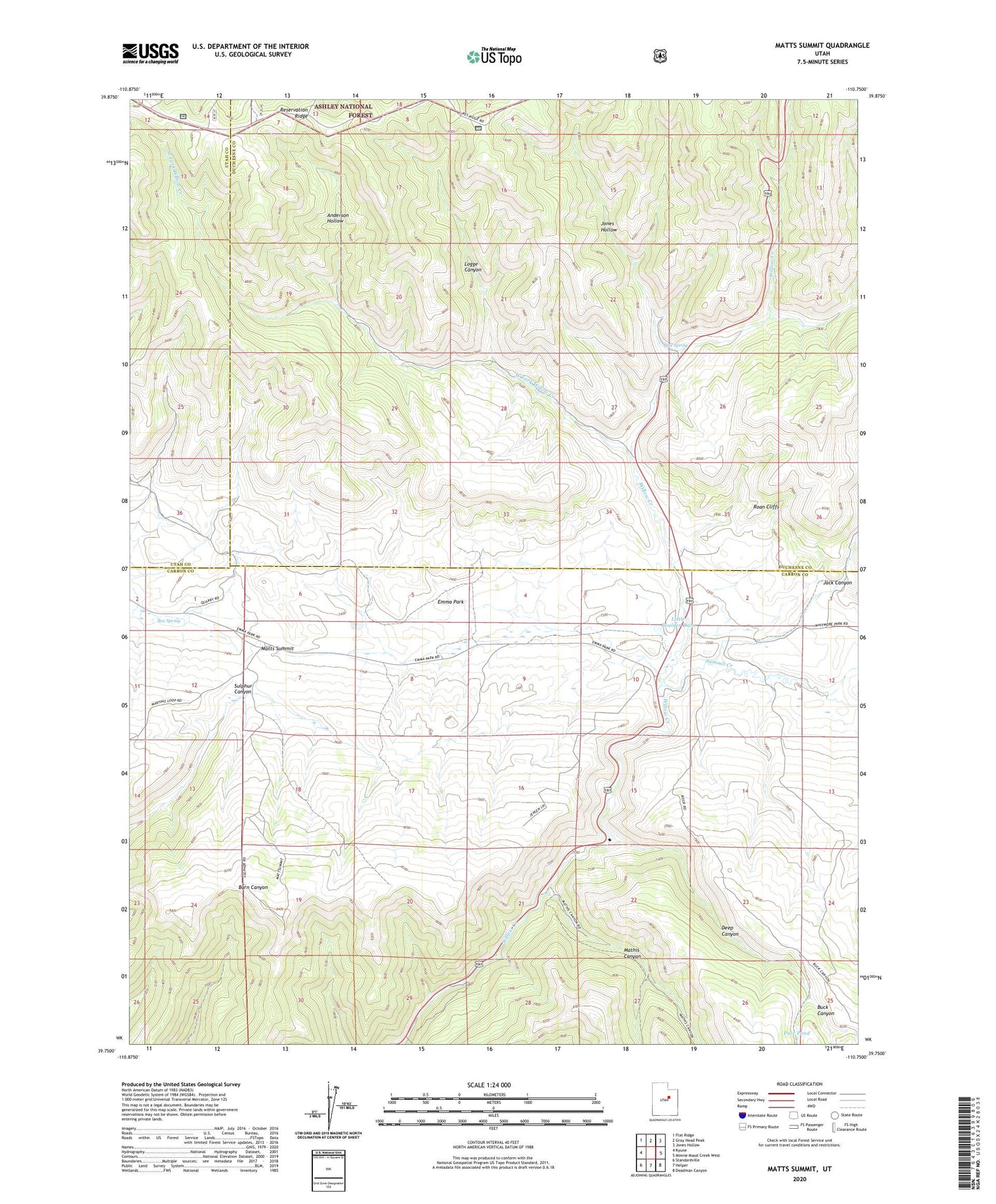
Matts Summit Utah US Topo Map
Couldn't load pickup availability
Also explore the Matts Summit Forest Service Topo of this same quad for updated USFS data
2023 topographic map quadrangle Matts Summit in the state of Utah. Scale: 1:24000. Based on the newly updated USGS 7.5' US Topo map series, this map is in the following counties: Carbon, Duchesne, Utah. The map contains contour data, water features, and other items you are used to seeing on USGS maps, but also has updated roads and other features. This is the next generation of topographic maps. Printed on high-quality waterproof paper with UV fade-resistant inks.
Quads adjacent to this one:
West: Kyune
Northwest: Flat Ridge
North: Gray Head Peak
Northeast: Jones Hollow
East: Minnie Maud Creek West
Southeast: Deadman Canyon
South: Helper
Southwest: Standardville
This map covers the same area as the classic USGS quad with code o39110g7.
Contains the following named places: Anderson Hollow, Bamberger Monument, Box Spring, Buck Canyon, Deep Canyon, Downard Cabin, Emma Park, Jack Canyon, Jones Hollow, Little Boulder Dam, Logge Canyon, Mathis Canyon, Matts Summit, Pace Pond, Pipe Spring, Summit Creek, West Fork Willow Creek