MyTopo
Helper Utah US Topo Map
Couldn't load pickup availability
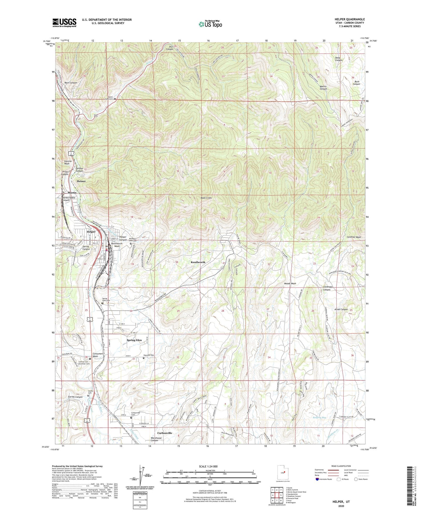
2023 topographic map quadrangle Helper in the state of Utah. Scale: 1:24000. Based on the newly updated USGS 7.5' US Topo map series, this map is in the following counties: Carbon. The map contains contour data, water features, and other items you are used to seeing on USGS maps, but also has updated roads and other features. This is the next generation of topographic maps. Printed on high-quality waterproof paper with UV fade-resistant inks.
Quads adjacent to this one:
West: Standardville
Northwest: Kyune
North: Matts Summit
Northeast: Minnie Maud Creek West
East: Deadman Canyon
Southeast: Wellington
South: Price
Southwest: Pinnacle Peak
This map covers the same area as the classic USGS quad with code o39110f7.
Contains the following named places: Aberdeen Mine, Alrad Canyon, Barn Canyon, Carbonville Cemetery, Carbonville Census Designated Place, Carbonville School, Castle Gate, Castle Gate Cemetery, Castle Gate Mine Number 1, Castle Gate Mine Number 2, Castle Gate Mine Number 4, Castle Gate Precinct, Central Cemetery / Slovenian Cemetery, City of Helper, Consumers Wash, Cordingly Canyon, Dry Canyon, Ewell Post Office, Garley Canyon, Gentile Wash, Glen Canal, Gorley Cemetery, Hardscrabble Canyon, Haycock Cemetery, Heiner, Helper, Helper Canyon, Helper Police Department, Helper Post Office, Helper Volunteer Fire Department, Kenilworth, Kenilworth Census Designated Place, Kenilworth Wash, Ketchum Mine, KOAL-AM (Price), Martin, Maxwell, Milburn Mine, Mountain View Cemetery, New Life Ministries Church, Panther Canyon, Panther Carbon Post Office, Price Canyon, Saint Anthony Catholic Church, Saint Anthony School, Sally Mauro Elementary School, Spring Canyon, Spring Glen, Spring Glen Cemetery, Spring Glen Census Designated Place, The Church of Jesus Christ of Latter Day Saints, Warehouse Canyon, Willow Creek, ZIP Code: 84529