MyTopo
Colton Utah US Topo Map
Couldn't load pickup availability
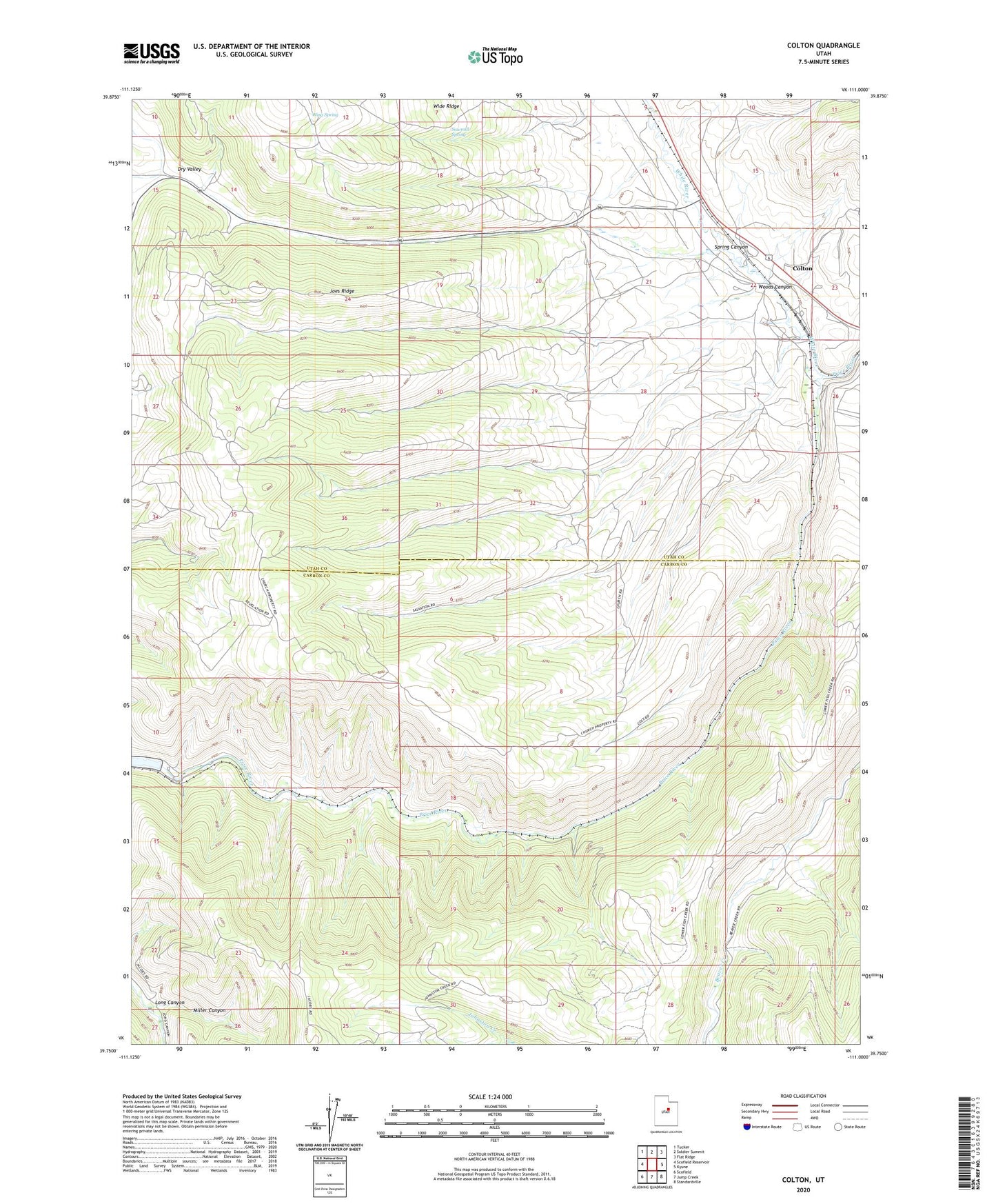
2023 topographic map quadrangle Colton in the state of Utah. Scale: 1:24000. Based on the newly updated USGS 7.5' US Topo map series, this map is in the following counties: Carbon, Utah. The map contains contour data, water features, and other items you are used to seeing on USGS maps, but also has updated roads and other features. This is the next generation of topographic maps. Printed on high-quality waterproof paper with UV fade-resistant inks.
Quads adjacent to this one:
West: Scofield Reservoir
Northwest: Tucker
North: Soldier Summit
Northeast: Flat Ridge
East: Kyune
Southeast: Standardville
South: Jump Creek
Southwest: Scofield
This map covers the same area as the classic USGS quad with code o39111g1.
Contains the following named places: Colton, Dry Valley, Hale, Joes Ridge, Long Canyon, Richards Ranch, Sawmill Spring, Scofield Dam, Spring Canyon, White River, Wide Ridge, Wing Spring, Woods Canyon